First Alert Mode: Wet Triangle, flash flood threats across the state

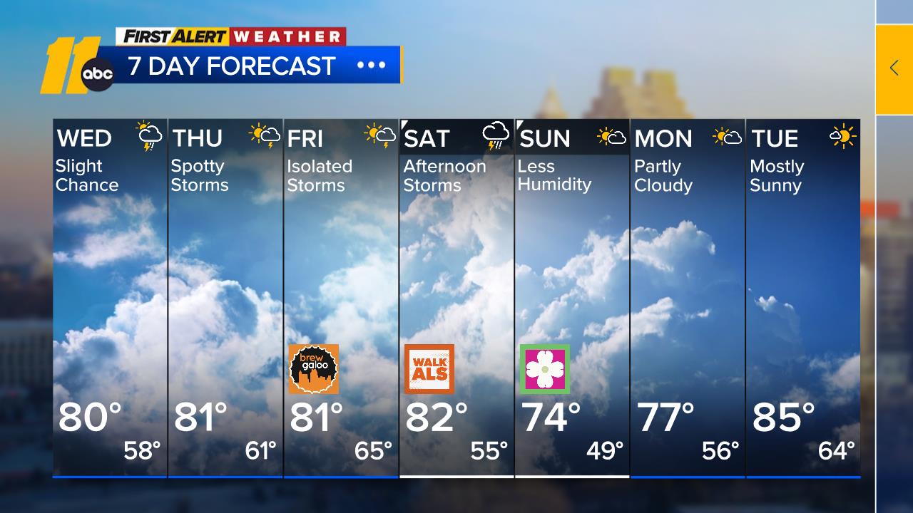
As Alberto pushes through, the Triangle is expected to see much more showers and thunderstorms.
An increase in moisture led to a wet Memorial Day with locally heavy rain into the early afternoon hours.
Flash flooding is possible throughout the week.
The rain made for unsteady conditions for drivers Monday evening, many of whom were making the trek back from Memorial Day getaways.
"We were going to go back to the pier and fish today and spend some time on the beach but it's been torrential downpours all day so we decided to head to Raleigh and hope for the best," said Annie Williams, who was driving from Minnesota, stopped in the Surf City area and is eventually headed down to Savannah for a graduation.
"We do have summer in Minnesota. It's not snowy and cold all the time regardless of what people believe," she said.
No serious wrecks were reported, though there was a spinout at I-40 and Rock Quarry Road.

Those wet driving conditions continued into Tuesday, making for some delayed and treacherous morning commutes.
On Monday, Gov. Roy Cooper's office said State Public Safety officials began coordinating with local officials and cautioning residents to monitor forecasts and warnings closely as heavy rains from Subtropical Storm Alberto further saturate North Carolina causing flash flooding and increasing the potential for landslides.
The bulk of Alberto's moisture should stay to our west on Tuesday, but daytime heating will add enough instability to bring us some showers and thunderstorms with locally heavy rainfall. More of the same is expected for Wednesday.
In western North Carolina counties, NCDOT monitored roadways for potential flooding and landslides because of already saturated ground from the rain that fell during the past week.
"Emergency management and law enforcement officials are working closely to respond to any trouble spots," Emergency Management Director Mike Sprayberry said. "We urge North Carolina residents and visitors to monitor local weather forecasts and heed warnings from local officials."
There are also concerns that some roads could flood in the eastern part of the state, where crews will be on standby to shut down roads that become unsafe because of floodwater.
Much of the state remains under a Flash Flood Watch that has been extended through Wednesday morning.
State Emergency Management meteorologists predict rainfall totals to reach three to six inches statewide with locally higher amounts possibly reaching 8 inches along the eastern and southern slopes of the mountains during the next few days.
By Monday night, minor flooding already occurred along the Roanoke River near Roanoke Rapids and officials are watching the Roanoke River near Williamston. Minor flooding is anticipated along the Cape Fear River at Wilmington from Tuesday morning through Wednesday and near Burgaw on Friday.
In western North Carolina, minor flooding is expected along the French Broad River near Blantyre on Wednesday.
Public safety officials also are monitoring the French Broad River at Asheville and Fletcher. Rainfall could lead to additional landslides across western NC where some of the greatest accumulations are expected.


