Classic August weather: Hot, humid conditions for a stretch across Central NC

RALEIGH, N.C. (WTVD) -- We're locked into a classic August weather pattern, with hot and humid conditions continuing each day.
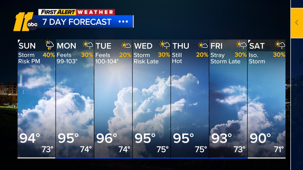
Highs will reach the low to mid-90s Saturday afternoon, and a few isolated thunderstorms could develop late in the day, mainly north and west of the Triangle.
A similar setup is expected Sunday, though storm coverage may be slightly higher.
The stretch of mid-90s is expected to continue through the upcoming week, with humidity pushing feels-like temps over 100. If you'll be spending time outdoors, be sure to take frequent breaks, stay hydrated, and limit strenuous activity during the hottest part of the day.
While most areas will remain dry, there will be daily chances for isolated afternoon storms. The best opportunities for rain appear to be Wednesday and Friday, although coverage still looks relatively limited at around 30% to 40%.
The tropics remain quiet for now. In an average Atlantic hurricane season, the third named storm typically forms around August 3. We're running a little behind that pace this year, and no tropical development is expected in the foreseeable future.
Have a great day!
Steve Stewart