First Alert Day: Flood Watch, severe storms threaten Triangle tonight | Live Radar


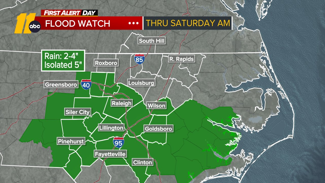
RALEIGH, N.C. (WTVD) -- First Alert Day-Flood Watch: A Flood Watch has been issued for the Triangle and south through Saturday morning. Rain totals of 2-5 inches will be possible, with isolated higher amounts. Excessive runoff may result in flooding of rivers, creeks, streams, and other low-lying and flood-prone locations.
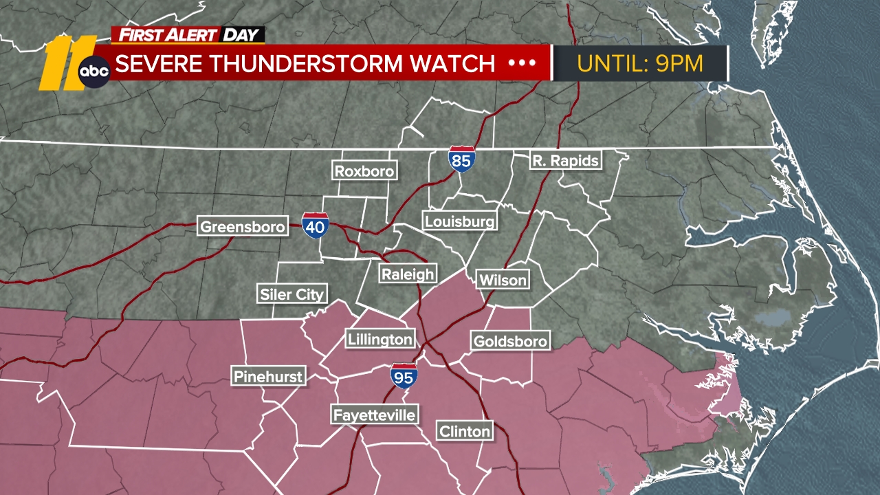
First Alert-Severe Storm Risk: Scattered to numerous thunderstorms are expected from late afternoon through tonight, which could be strong to severe storms with damaging winds and hail.
CLICK HERE FOR LATEST SEVERE WEATHER ALERTS
Our heat wave is over, with temperatures today expected to peak in the mid/upper 80s with increased cloud cover. A stalled front will be the impetus for thunderstorms late this afternoon and evening, with the potential for heavy rain and strong to severe thunderstorms. Flash flooding, along with damaging wind gusts and hail, will be possible.
Highs will be in the mid/upper 80s.
Thunderstorms gradually lose intensity and move northeast out of the viewing area after midnight. The Triangle will be positioned at the base of the trough tomorrow, which will keep the region mostly cloudy and bring the chance for thunderstorms during the afternoon and evening. Activity looks to be less widespread compared to today, but there will still be some heavy downpours.
Activity falls apart as we head toward midnight tomorrow night.
The front clears the area Sunday, which will allow for more sunshine and a slightly warmer setup. A thunderstorm cannot be ruled out across far eastern portions of the viewing area, but most activity should remain closer to the coast.
Drier conditions continue through early next week, with cooler northeasterly flow keeping temperatures in the mid-80s despite more sunshine. Guidance continues to indicate a disturbance passing through the region around midweek, which will bring thunderstorm chances back to the Triangle by Wednesday.

For the North Atlantic...Caribbean Sea and the Gulf:
1. Northeastern Atlantic:
A non-tropical area of low pressure is developing along a front over
the northeastern Atlantic a few hundred miles north-northeast of
the Azores. This system could separate from its front and acquire
some subtropical or tropical characteristics on Saturday or early
Sunday while it moves east-southeastward at 10 to 15 mph toward
Portugal and northwestern Spain. For more information, see High Seas
Forecasts issued by Meteo France.
* Formation chance through 48 hours...low...20 percent.
* Formation chance through 7 days...low...20 percent.
2. Central Subtropical Atlantic:
A weak area of low pressure located over the central subtropical
Atlantic a few hundred miles east-southeast of Bermuda is producing
a concentrated area of showers and thunderstorms southeast of its
center. Surface pressures in the area are relatively high; therefore
development of this system, if any, is expected to be slow to occur
while it drifts west-southwestward through Sunday and then turns
northward early next week.
* Formation chance through 48 hours...low...10 percent.
* Formation chance through 7 days...low...20 percent.
Have a great day!
Kweilyn