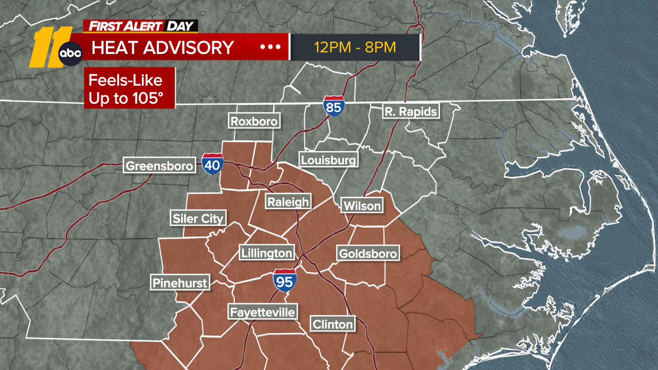
Flash Flood Warnings in place as storms move through


ABC11 is in First Alert Mode as storms move through central North Carolina.
Get weather alerts sent right to your phone with the ABC11 News App
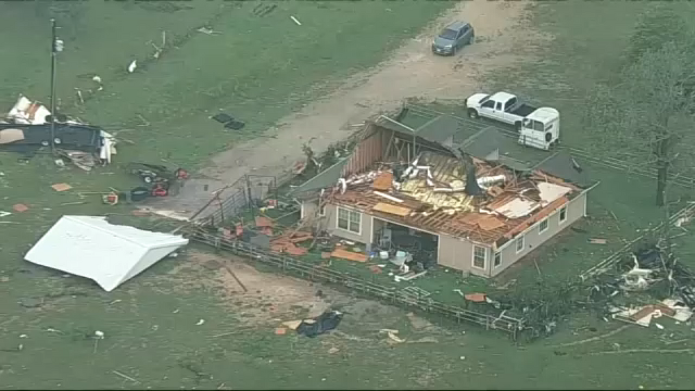
Earlier a Tornado Warning was issued for Warren and Vance counties until 9:45 p.m., so far there are no reports of any damage.
Across the Triangle, more than 5,000 people were reported to be without power.
The following counties are under a Flash Flood Warning until 12:45 a.m: Chatham, Durham, Granville, Harnett, Lee, Moore, Orange and Wake.
Up to two inches of rain have already fallen in parts of our area and the National Weather Service says flash flooding is expected to begin soon.
According to the NWS, flash flooding is extremely dangerous. Numerous roads and low lying areas will quickly flood. Flood waters will also threaten some homes and businesses. If you are experiencing flooding or live in a flood prone area, move to higher ground.
The following counties are under a Tornado Watch:
Alamance, Anson, Caswell, Chatham, Cumberland, Davidson, Durham, Forsyth, Granville, Guilford, Harnett, Hoke, Lee, Montgomery, Moore, Orange, Person, Randolph, Richmond, Robeson, Rockingham, Scotland, Stanly, Stokes, Vance, Wake.
VIEW THE LATEST WEATHER ALERTS HERE.
The Tornado Watch is in effect until 11 p.m.
RELATED: What to do when you see a tornado while driving
The main threat is for damaging straight-line winds; however the tornado risk has increased as well. Timing for severe weather will be 8 p.m. in our western counties, 9-10 p.m. in the Triangle and 11 p.m. along the I-95 corridor. Please be weather aware this evening. We'll keep you updated...
RELATED LINK: Damaging winds, heavy rain moving onto East Coast to start week