Pleasant week of weather ahead

RALEIGH, N.C. (WTVD) -- First Alert: After weekend rain chances, a drier pattern is expected to start the week.
Variably cloudy skies are expected through the evening, but slow clearing is expected overnight. Lows will be in the 60s.
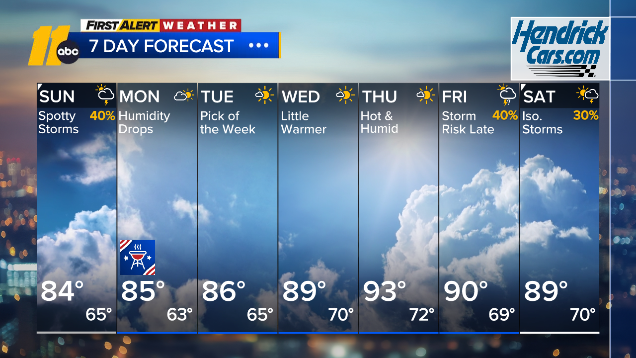
Drier air arrives for Labor Day as dew points fall into the low to mid 60s. That low humidity combined with highs in the low to mid 80s will make for a pleasant day for outdoor plans.
Even more comfortable air settles in Tuesday with plenty of sunshine, highs in the mid 80s, and dew points dropping into the 50s.
Wednesday will be a nice day, but it will be a little warmer and a little more humid. Highs will be in the upper half of the 80s.
The warmest day of the week looks to be Thursday, with highs reaching the low to mid 90s. Temperatures ease back a bit on Friday, and a cold front approaching the area could bring a chance of showers and storms both Thursday night and Friday afternoon.
The front that brings Friday's rain chance could stall at the coast. There is some uncertainty regarding how dry or wet next weekend will be. Check back for updates throughout the week.
Have a great night!
Cruz Medina