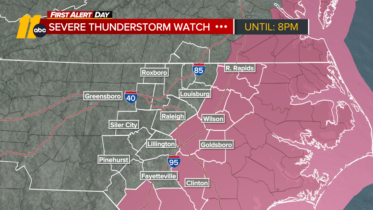
Timeline of Monday's snow chances

Monday, March 12, 2018

Parts of the Triangle-area could see some snowfall Monday but Big Weather says it won't be enough to build a snowman.
READ MORE: Okay, it's Monday. Where is the snow?
With all this talk of snow, here's what you can expect:
Snow timeline
- It will be a chilly start to the day with lower temperatures (30s) carrying on into the afternoon
- Rain will fall until lunchtime before switching over to snow between 3 - 5 p.m.
- Could end as an "all snow event" (or we may see some sleet) by 7 p.m., dropping half an inch to an inch at most in Triangle areas; however, 1-2" are possible along and north of I-85 on grassy and elevated surfaces
- Evening commutes could be slick but the grounds will be warm. Drivers should take their time driving
- Big Weather says all of the precipitation has the chance to freeze causing slick roads for Tuesday's morning commuters
Copyright © 2026 WTVD-TV. All Rights Reserved.