80s by Mid-Week

RALEIGH, N.C. (WTVD) -- A few heavy showers popped up south of RDU and moved through early this afternoon. More clouds have kept temperatures from getting too hot today, but it's still very muggy. With plenty of moisture in the air, any storms that develop could produce very heavy rain and some localized flooding. The risk of severe weather remains low.
Showers and storms may continue on and off through much of tonight before fading late. Heavy rain remains the main concern, but conditions gradually improve by tomorrow morning.
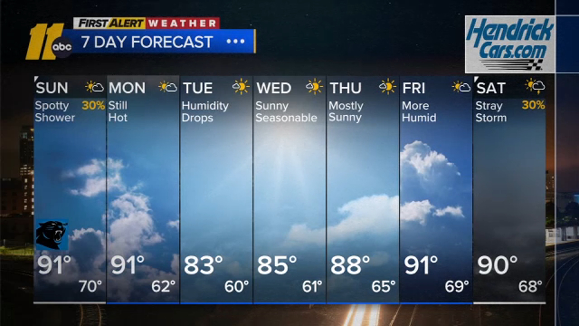
Storm chances on Sunday are looking lower than previously expected because the next front is arriving more slowly. A few storms could still produce gusty winds, but coverage will be extremely scattered. Most forecast models show fewer storms around the Triangle, so rain chances have been lowered to around 30%.
Monday will still be warm, with highs around 90, but humidity slowly starts to decrease. A much more noticeable drop in humidity arrives Tuesday, bringing the first real taste of fall. Even with plenty of sunshine, temperatures stay close to normal.
The comfortable air sticks around through Wednesday and much of Thursday before humidity begins to creep back up on Friday. Another front is expected to stall north of the area next weekend.
Saturday could be a little hotter than 90 degrees, although an easterly breeze may help keep temperatures from climbing too much.
Have a great evening!
Big Weather