Unsettled pattern to start the work week

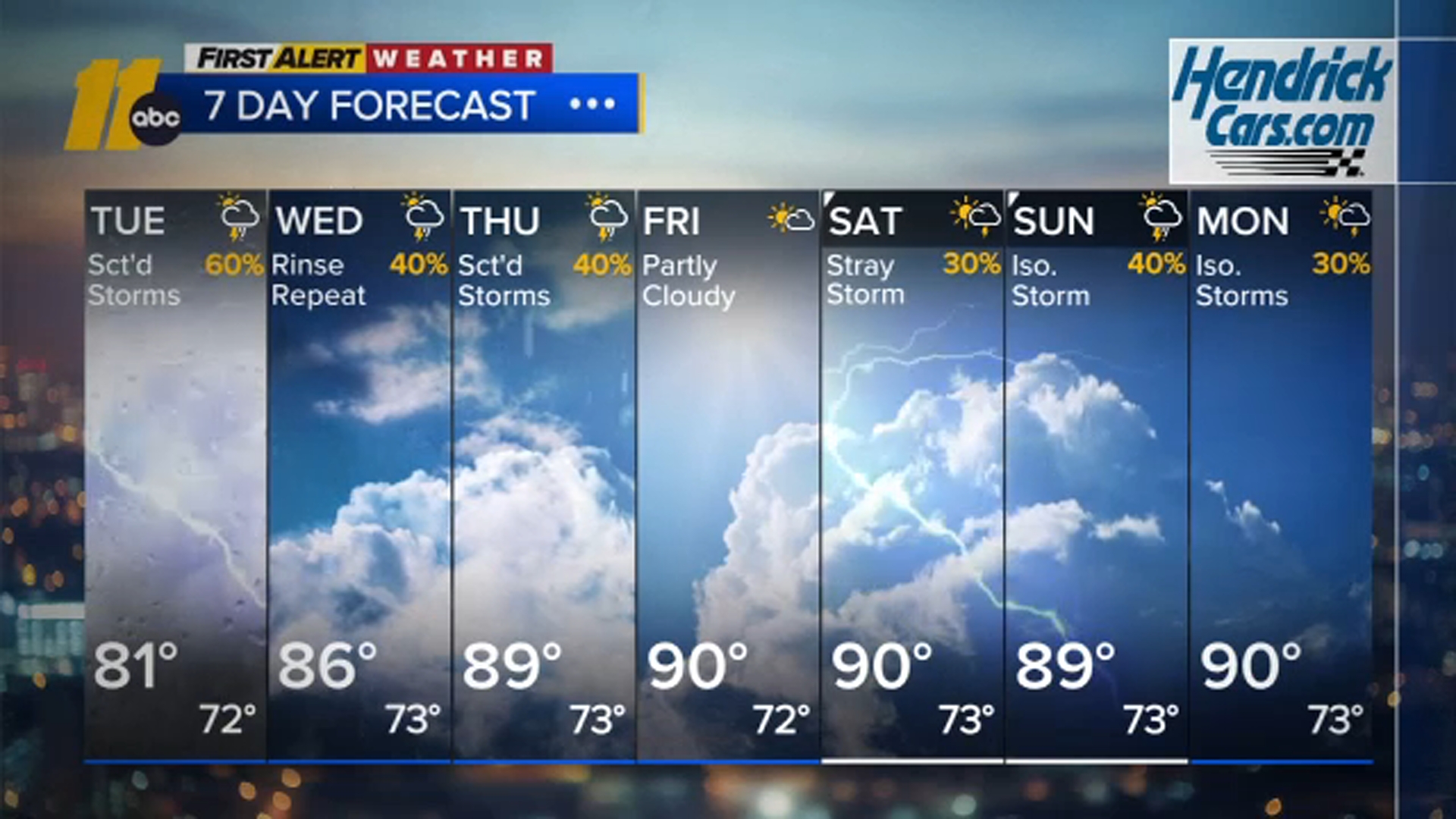
RALEIGH, N.C. (WTVD) -- First Alert-Unsettled Week with Locally Heavy Rain: Scattered to numerous showers and slow-moving storms will be capable of producing rain rates of 1-2 inches per hour, which may cause some localized flooding. Afternoon storms will be possible each day through the end of the week, but the threat of flooding is expected to decrease by midweek and through the weekend.
This evening will feature isolated showers and storms. Temperatures will drop into the 70s tonight with a mostly cloudy sky.
Rounds of showers and thunderstorms will be the theme through the middle of the week as an upper trough lingers to our west, along with plenty of moisture being funneled in from the Atlantic and the Gulf. Quick downpours may lead to localized flooding.
Tuesday will be the wettest day of the week as scattered showers develop throughout the morning and continue into the afternoon and evening. Embedded storms could cause localized flooding and/or ponding on roadways. Highs will only be around 80 degrees.
Temperatures through the middle of the week will run 5 to 10 degrees below the historical average due to clouds and rain.
The deepest moisture begins to shift out of the region later in the week, reducing thunderstorm coverage and the threat for flooding downpours. Spotty afternoon thunderstorms will persist through the weekend. 7-day rain totals will be around 0.50" to 1.50" for most.
The rainfall may not feel welcome after the past month's wet weather, but it will continue to help alleviate the ongoing drought. Much of the state remains in some level of drought, with only the Outer Banks and a small portion of the Appalachians free of drought designation. Much of the extreme drought and nearly all of the exceptional drought have been
erased thanks to July's near-record rainfall. As a reminder, RDU recorded its second-wettest July on record with 12.16 inches of rain, with the 95-year-old record of 12.36 inches set in 1931 able to hang on by a thread!
Have a great night!
Cruz Medina