A hot and stormy Saturday in the works

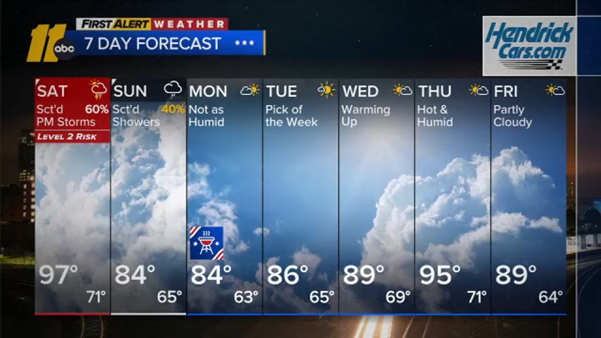
RALEIGH, N.C. (WTVD) -- Heat advisories remain in effect until 8 PM this evening. Latest models show storms firing up to our north and moving southeastward through the area. There is a t-storm watch for most of the region.
CLICK HERE FOR SEVERE WEATHER ALERTS
These storms can produce large hail and damaging winds as they move through the viewing area this evening into tonight. Southern areas may miss out on this activity as thunderstorms lose intensity.
Tomorrow will be hot once again with another heat advisory for part of the area, but a little bit cooler than today in spots following thunderstorms. Records are still expected to be challenged, with RDU only sitting at 98 (2023). Thunderstorms move in as a cold front drops southeast through the area. Any storm will bring the potential for damaging wind gusts.
This cold front will bring an end to our heatwave.
Highs starting Sunday will drop into the mid 80s, with dewpoints in the upper 60s on the latest guidance. Labor Day and Tuesday will feature mid 80s temperatures and dewpoints in the 60s, setting up a very nice start to the week.


In the longer range, temperatures return to the 90s by the middle of next week and could even reach heatwave criteria on Thursday, but it still looks less humid.
Have a great weekend!