Dry and humid Saturday, Level 1 severe risk Sunday

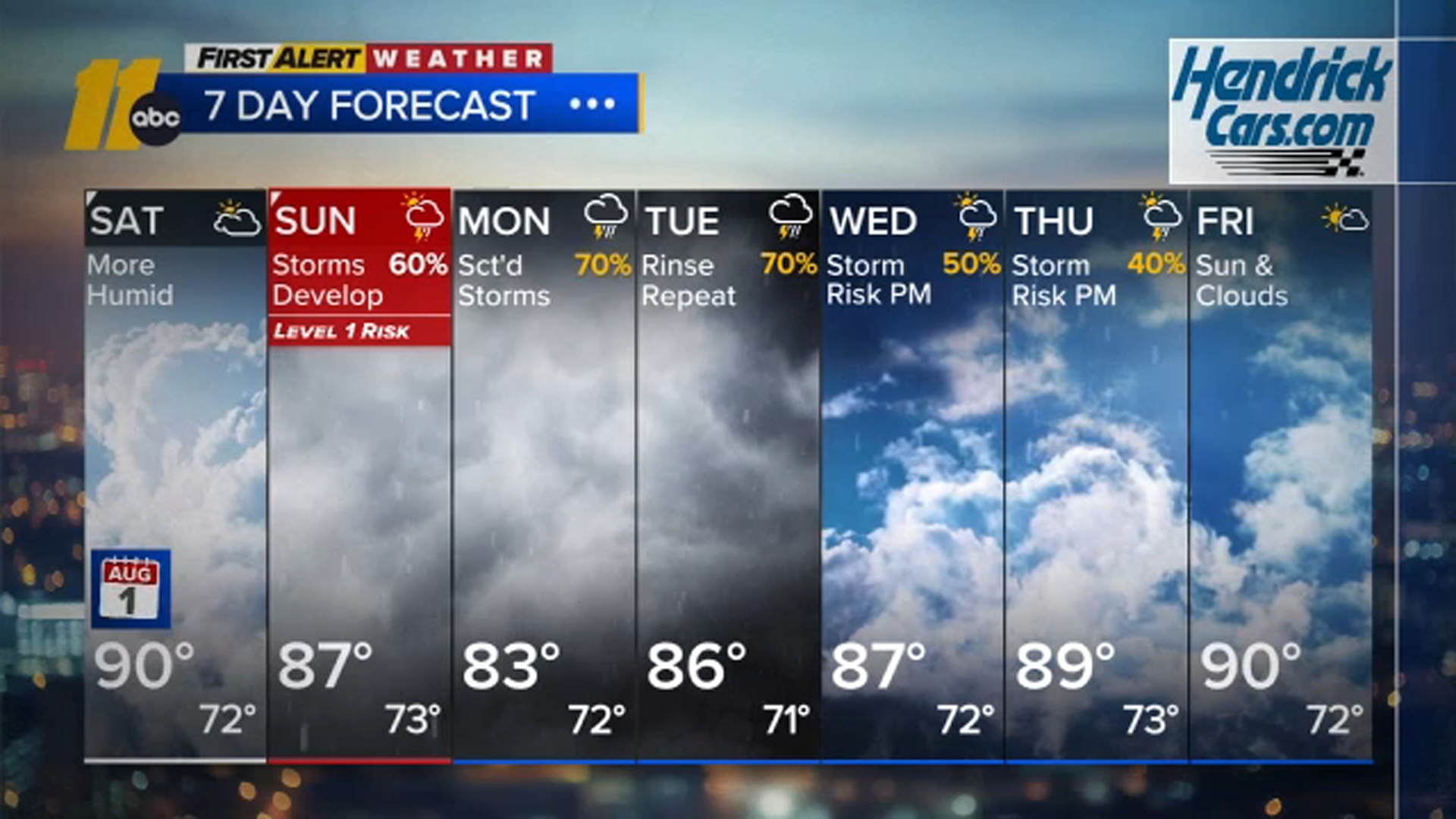
RALEIGH, N.C. (WTVD) -- Expect a mix of clouds and sunshine today with highs in the upper 80s. It will feel a bit more humid than the past couple of days.
Tonight turns cloudy and muggy with a chance for a few late-night showers. Sunday looks unsettled with scattered showers and thunderstorms developing during the day.
The Storm Prediction Center has central North Carolina under a Level 1 (Marginal) Risk for isolated strong storms. A few storms could produce brief heavy rain and gusty winds.
Storms will generally move from south to north, which raises the possibility of a few training thunderstorms. If that happens, localized minor flooding could develop in some areas.
Little change is expected Monday and Tuesday, although storm coverage may be a bit lower. By the end of next week, expect mainly hit-or-miss afternoon and evening storms.
Have a great day!
Steve Stewart