First Alert Day: Breezy, wet Thursday with rounds of rain and storms


RALEIGH, N.C. (WTVD) -- Central North Carolina is off to a soggy and breezy start Thursday, with waves of showers and a few thunderstorms moving through the area.
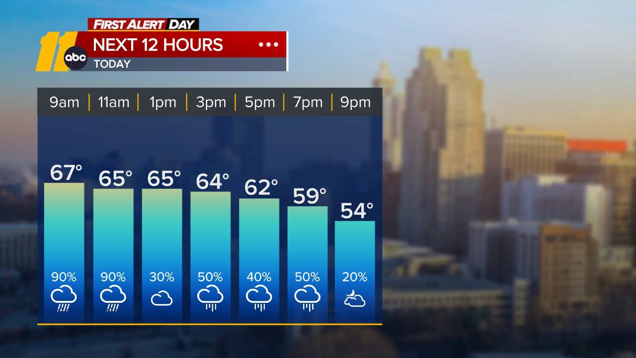
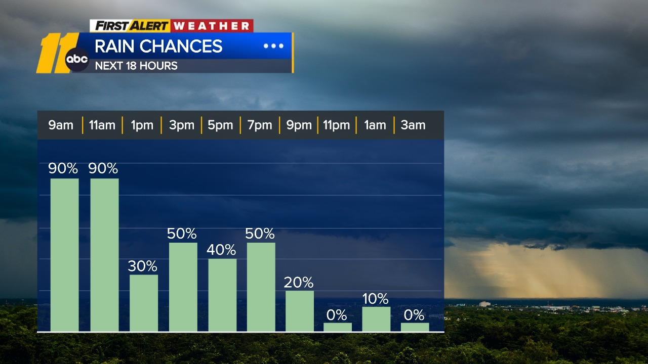
Rain and storms will be on and off through the morning into the early afternoon. Some of the rain will be heavy at times, especially during the morning commute. Forecasts show the steadiest rain falling early in the day before gradually easing later on.
What to expect today
- Periods of rain and storms this morning into early afternoon
- Locally heavy downpours possible
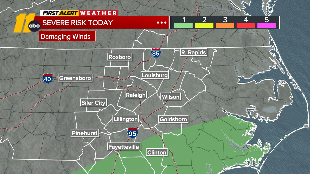
- Isolated strong wind risk south of the Triangle, including parts of Cumberland and Sampson County
- Breezy at times as a cold front moves though
Rainfall totals through Friday evening are expected to range from about a half-inch to an inch and a half for most areas, with some spots nearing 2 inches. Those higher totals could help make progress on easing drought conditions.
Temperatures will be a bit unusual Thursday -- highs in the mid to upper 60s will happen early, likely during the morning. After that, temperatures will begin to fall.
Showers taper off later today
A few spotty showers could linger into the evening as the front moves offshore. Behind the front, cooler and drier air arrives Thursday night, with temperatures dropping into the upper 40s.
Looking Ahead
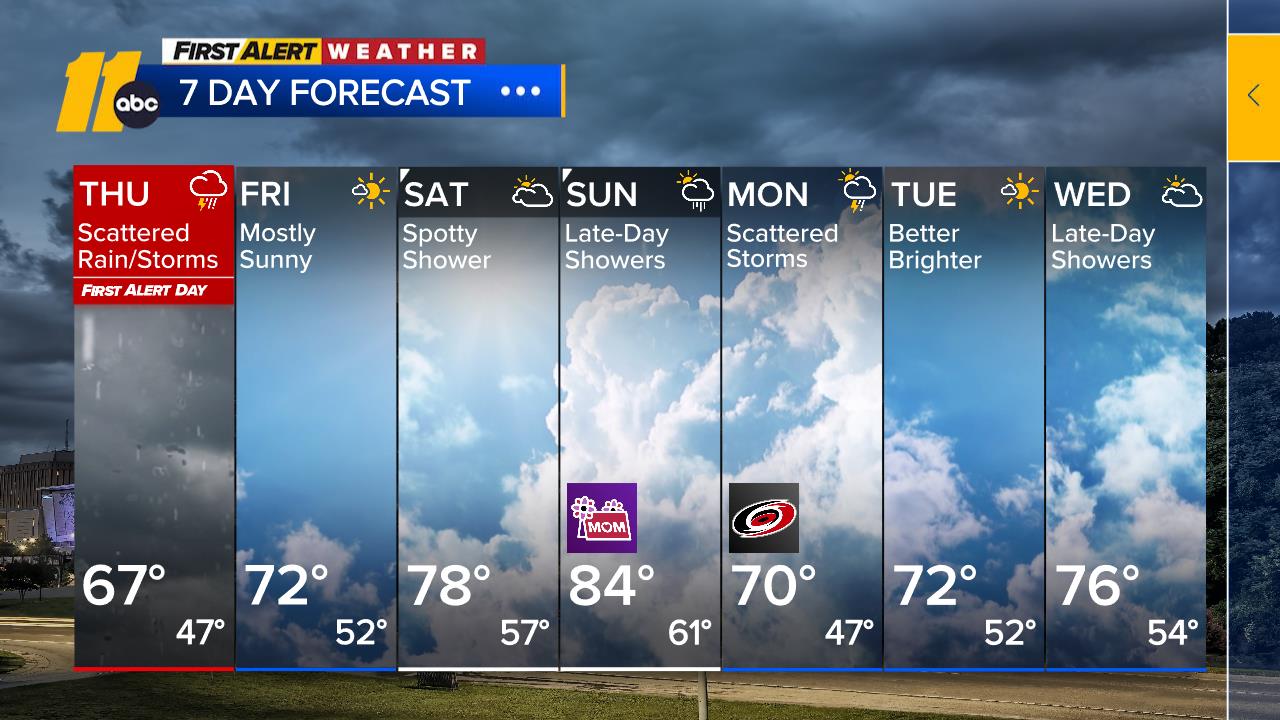
Friday: A much nicer day. High pressure builds in, bringing sunshine, lower humidity, and highs in the low 70s.
Saturday: Mostly dry and warmer, though an isolated shower can't be ruled out.
Sunday into Monday: Rain chances increase again as the next system approaches. Showers could become more widespread late Sunday through Monday night. Temperatures will warm into the upper 70s to mid 80s over the weekend before cooler air returns early next week.