Storms could return Wednesday afternoon, cooler temps for tonight

RALEIGH, N.C. (WTVD) -- It was a messy commute for some Wednesday morning due to the chance of severe weather moving in overnight.
Don't let your guard down, there is another risk for storms Wednesday afternoon. However, most of the day is expected to be dry. Highs will be in the low 80s north, mid/upper 80s in the Triangle, and low 90s in the Sandhills.
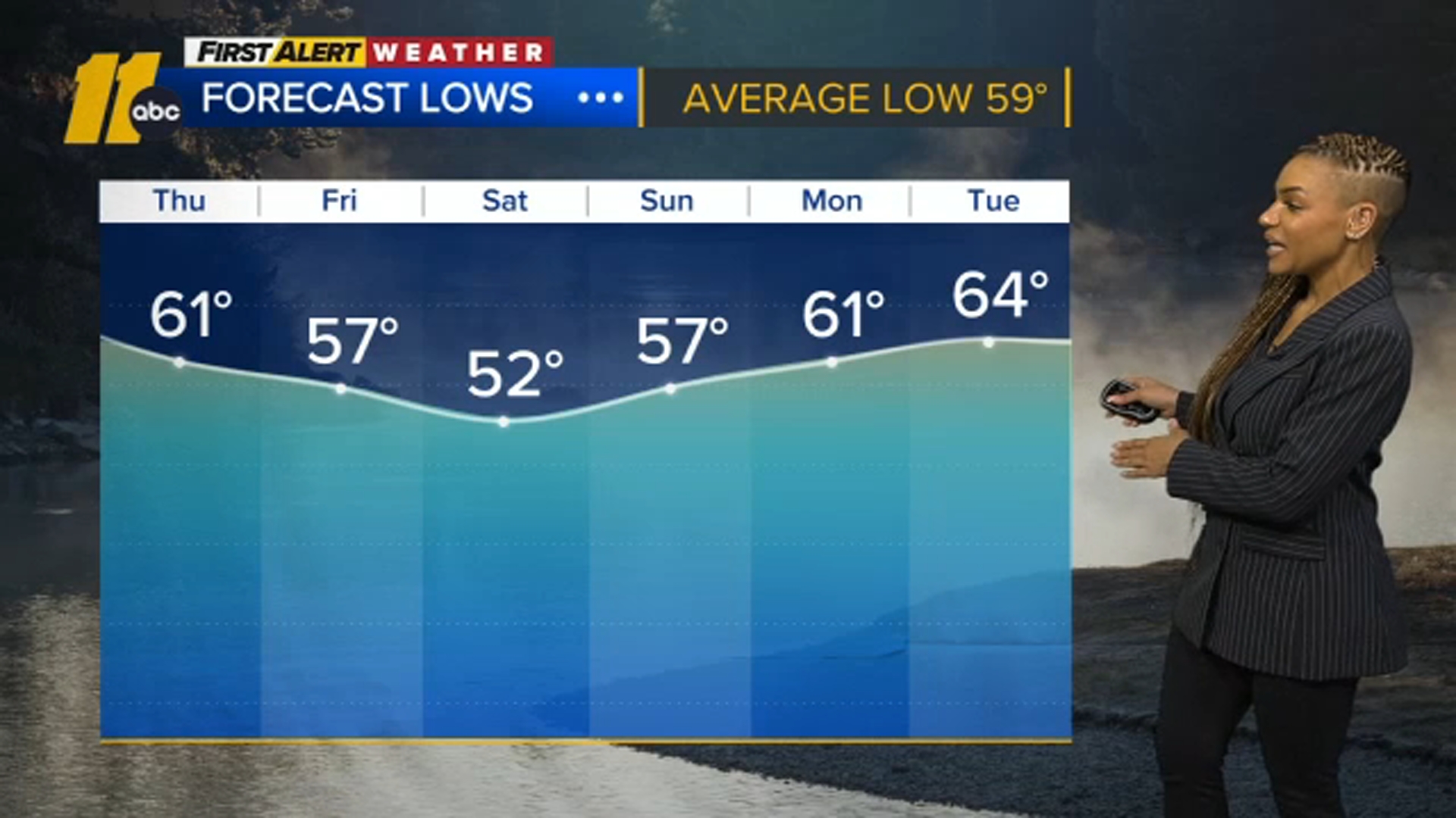
Tonight will be cooler with clear skies and lows in the upper 50s to low 60s.
Look Ahead
Thursday will be mostly sunny and breezy at times with gusts near 30mph. Highs will be in the low 80s. Another weak front will pass Thursday, and a stray late-day shower will be possible.
A few clouds are possible Friday with a disturbance north of the region, but skies will remain generally bright into the Memorial Day Weekend.
Saturday expected to be dry with a high pressure slipping into the area. High temperature could reach 78.
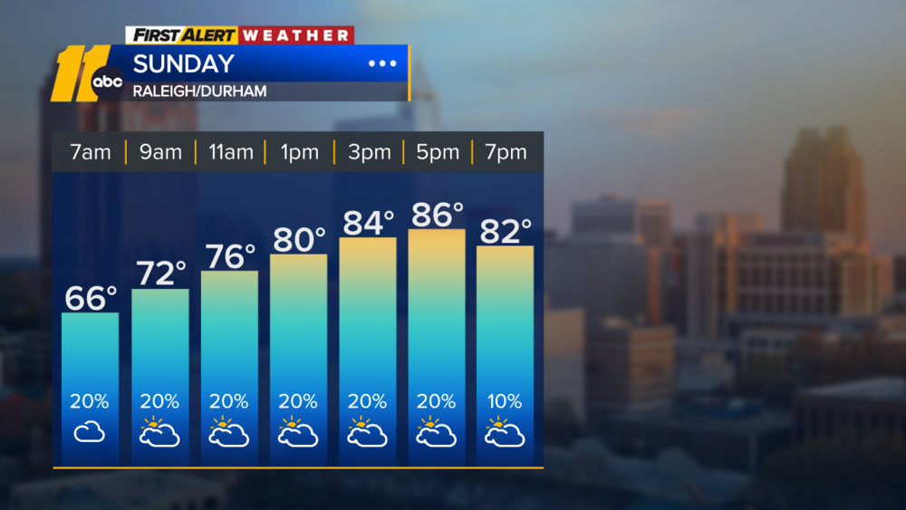
Sunday there is a chance of an evening shower. High temperature could reach 78.
Memorial Day starts dry, but scattered showers and spotty storms will be possible later in the day. Temperature on the cooler side of