Dangerous heat continues in central NC; storms, brief cooldown ahead

RALEIGH, N.C. (WTVD) -- It's another First Alert Day across central North Carolina, with dangerous heat and the threat of severe storms expected to impact the Triangle through Sunday evening.
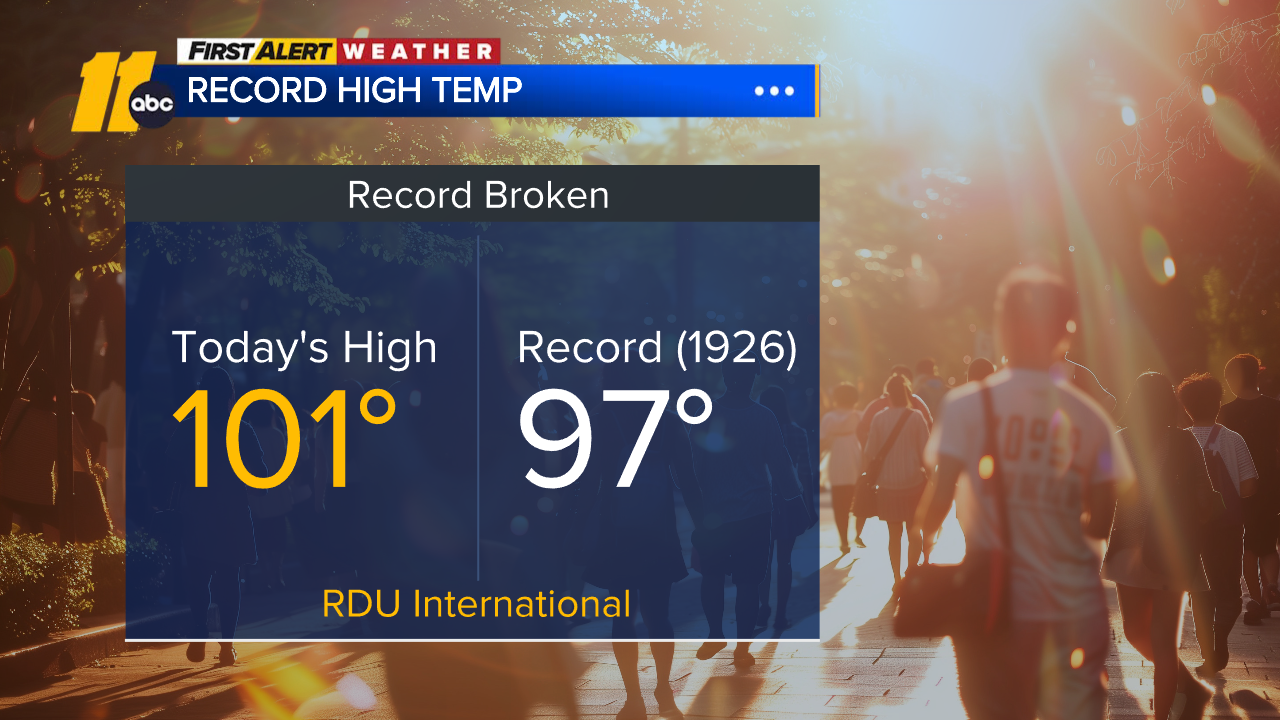
Sunday marks the third day this week that record temperatures have been broken, with Raleigh hitting 101 degrees at RDU International Airport shattering the previous record.
A Heat Advisory remains in effect until 8 p.m. as feels-like temperatures climb into the triple digits. Afternoon heat index values are expected to range from 100 to 105 degrees, increasing the risk of heat-related illness.
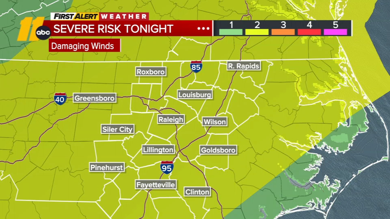
Along with the heat, most of ABC11's viewing area is under a Level 2 risk for severe storms, meaning scattered strong storms are possible later in the day.
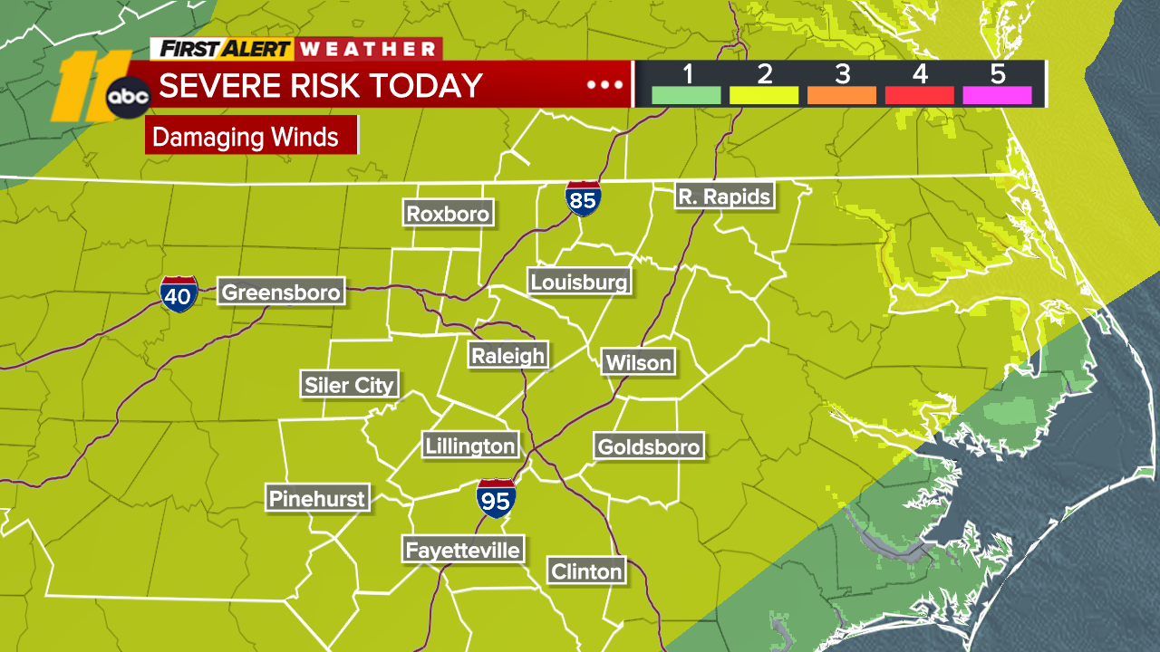
A few storms could develop by mid-afternoon, but the better chance arrives after 5 p.m. Forecasters say any storms that form could bring damaging wind gusts, which is the primary threat.
The combination of high heat and humidity can quickly lead to dehydration or heat-related illnesses, especially for those spending extended time outdoors.
SEE ALSO: Dangerous heat leads to families, workers changing daily routines to stay safe
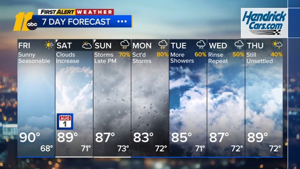
Looking ahead:
Monday: Slightly cooler with dropping humidity by the afternoon
Tuesday: Highs briefly dip into the 80s
Wednesday: Heat builds back in
Thursday: Record highs possible across the Triangle
Friday: An approaching front brings a better chance for showers and storms
Forecasters say the stretch of hot, humid weather will continue to create uncomfortable and potentially dangerous conditions, especially during peak afternoon hours. A brief cooldown is expected to start the week before heat builds again.
What to know about the heat:
The National Weather Service urges people to:
- Drink plenty of water
- Limit time outdoors during peak heat
- Check on vulnerable neighbors
- Never leave children or pets in vehicles
Hot temperatures combined with high humidity can quickly lead to heat-related illness if precautions are not taken.