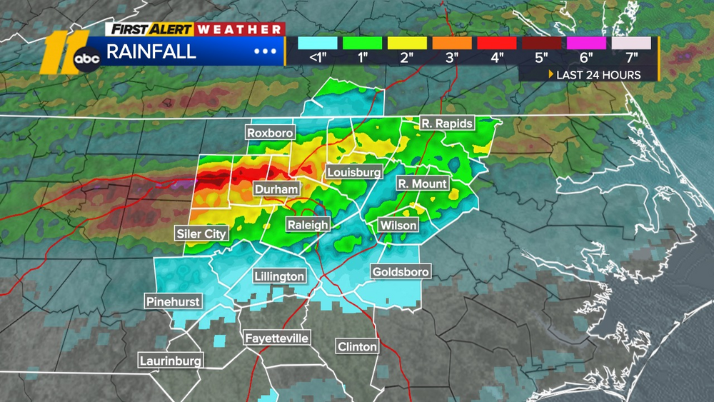
More rain expected overnight and into the start of the weekend

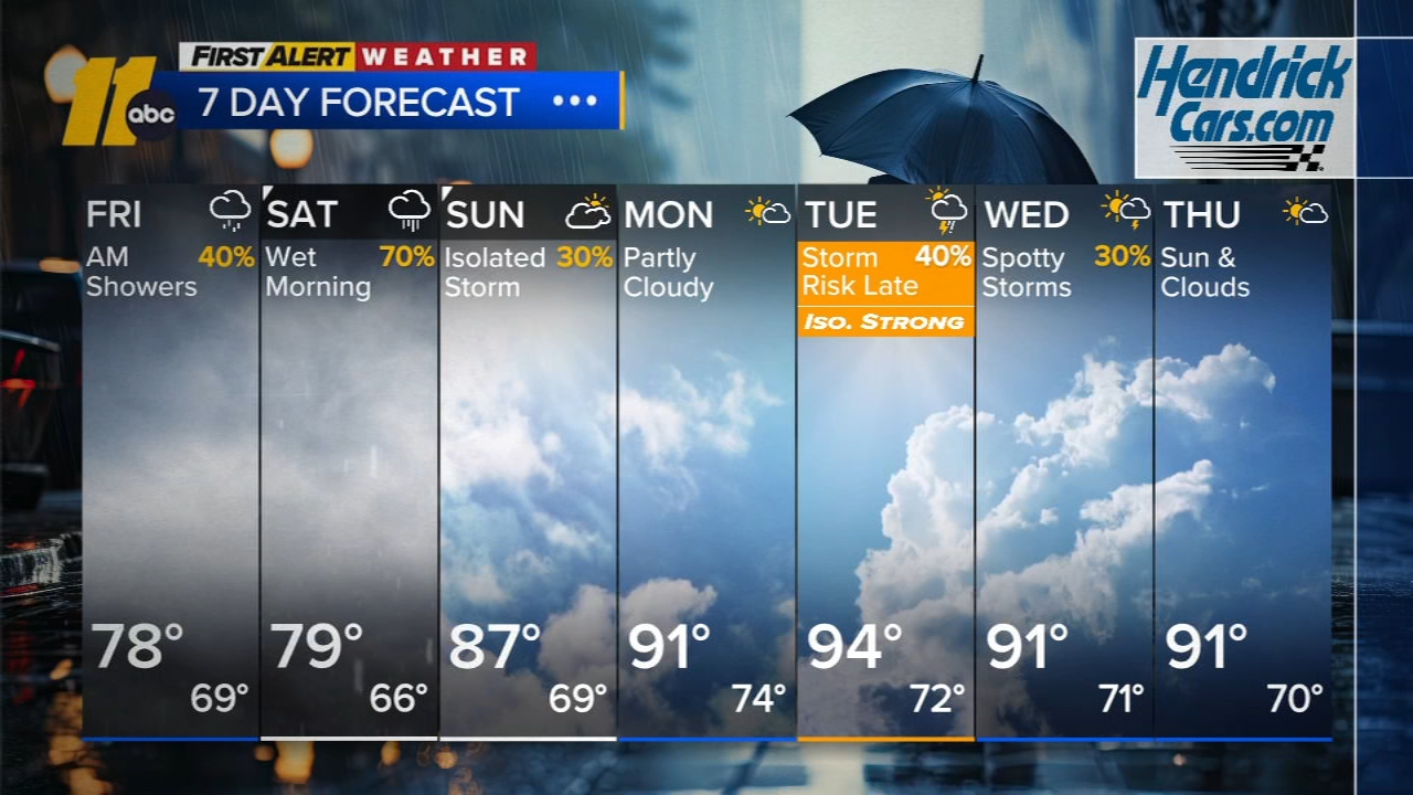
RALEIGH, N.C. (WTVD) -- First Alert: More rain returns overnight and lingers into Saturday. Drier conditions return Sunday, and temps climb back to the 90s next week.
The early evening hours will be dry, but more rain is expected to build into the area tonight. While the threat of flooding isn't as significant as it was on Thursday, isolated flooding and ponding on roads is possible overnight into early Saturday.
Saturday will start off very wet so outdoor plans in the morning are not advised. High pressure builds in from the north late tomorrow, bringing drier weather later in the day. Highs will remain in the 70s at RDU.
Temperatures will begin to rebound on Sunday, with highs in the mid- to upper 80s under partly sunny skies.
Monday continues this trend, with temperatures approaching 90 degrees.
Tuesday and Wednesday still look like the most likely days for thunderstorms, though most of the rain/storms are expected in the overnight hours of Tuesday. Highs will be in the low to mid 90s with lows in the 70s.
Have a great weekend!
Cruz Medina