Not as hot or humid through midweek
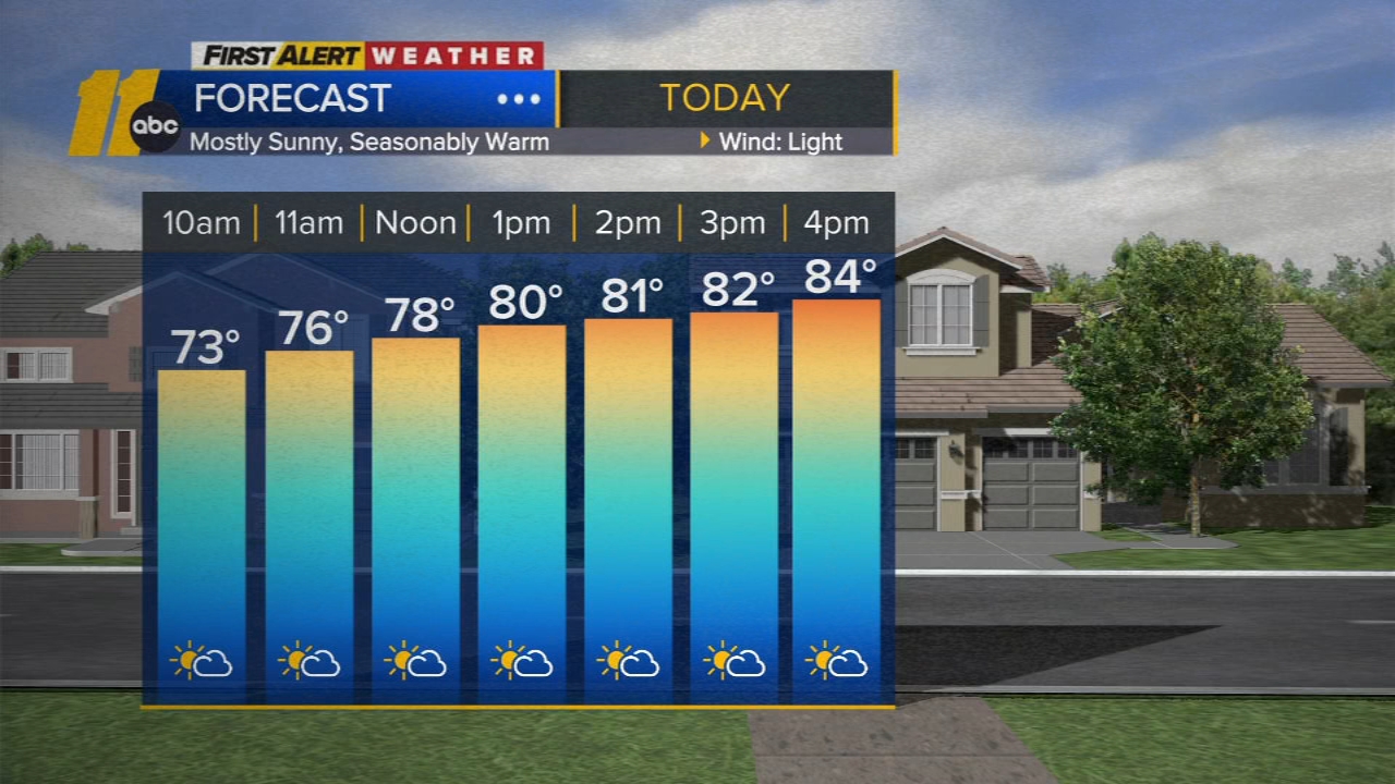

RALEIGH, N.C. (WTVD) -- Good morning! The front is well south of the area. With lower humidity and seasonable temps, it will be a beautiful and typical mid-September day. Out-the-door temps are in the 60s for most. Highs will be in the low to mid 80s under a mix of clouds and sun.
Tonight will be the coolest of the week with lows in the 50s. Highs return to the mid 80s Wednesday.
Afternoon temperatures increase a bit Thursday with plenty of sunshine, but it will remain relatively comfortable with lower humidity. Highs will be around 90.
Dew points rise on Friday ahead of another front. A few showers will be possible Friday afternoon as a front approaches from the north. Spotty showers and storms will be possible this weekend.
Weekend highs will be around 90 with feels-like temps in the mid/upper 90s.
Looking ahead, an area of low pressure may develop off of the Southeast coast and slide towards the northern Gulf coast this weekend. This feature may play a role in bringing more widespread rain chances to the area next week.
For the North Atlantic...Caribbean Sea and the Gulf of America:
1. Central Subtropical Atlantic:
A trough of low pressure located well east-southeast of Bermuda
continues to produce disorganized showers and thunderstorms.
Environmental conditions are forecast to become more conducive for
development in a few days, and a tropical depression could form late
this week as the system moves slowly west-northwestward over the
subtropical Atlantic.
* Formation chance through 48 hours...low...near 0 percent.
* Formation chance through 7 days...medium...40 percent.


Have a great day!
Kweilyn