NC12 reopens on north end of Ocracoke, state of emergency lifted nearly week after Erin

WTVD logo
Last updated: Tuesday, August 26, 2025 12:00AM GMT
Tracking Hurricane Erin: NC coastline battered, parts of NC12 shutdown

NORTH CAROLINA (WTVD) -- Hurricane Erin is moving away from the NC coast and the Outer Banks.

The National Hurricane Center in Miami reported Friday evening that Erin had weakened to a Post-Tropical Cyclone.

Erin's impact on the Outer Banks was mainly on Wednesday night into Thursday.

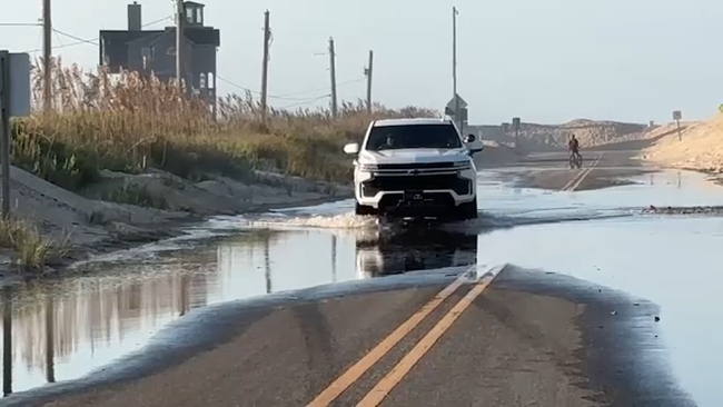
That said, even though the storm remained in the ocean due to its massive size, the NC Outer Banks are still dealing with the effects of it, which include flooding and overwash.

NC 12 was greatly impacted, leading to the closure of the highway indefinitely.

Dangerous rip currents created by the storm led many beaches to warn against swimming.

Aug 20, 2025, 9:36 PM GMT

NC 12 on Outer Banks to close until further notice

The North Carolina Department of Transportation (NCDOT) says that all lanes of NC12 are closed until further notice, from the north end of Ocracoke Island between the Ocracoke Island Airport and the North Ferry Terminal.

Overwash and sand on the road have made it unsafe.

NC 12 will reopen as soon as it is safe to do so, NCDOT said in a social media post.

Crews have been busy in the area putting up protective dunes.
WTVD logo
Aug 20, 2025, 5:20 PM GMT

NC Governor Josh Stein gives update on Hurricane Erin

North Carolina Governor Josh Stein gave an update on how the state is preparing for Hurricane Erin as it moves to the north.

Currituck, Hyde, and Dare counties are under evacuation orders.

In preparation, the state has deployed 3 swift water rescue teams positioned on the coast to respond if needed.

200 National Guard troops have been deployed with high clearance vehicles to navigate through any flood waters.

Read more here

WTVD logo
Aug 20, 2025, 6:10 PM GMT

Current conditions on the NC coast as Erin nears

Conditions in the Outer Banks are only expected to get worse as Hurricane Erin moves up the Atlantic Coast.

Coastal flooding began Tuesday and should continue through Thursday.

The system is moving closed to the coast.

The storm is expected to swing to the northeast late Wednesday night into Thursday morning, where it comes closest to the coast.

Even in fair weather, beaches will remain dangerous through Thursday night with waves of 10-20 feet. There were 85 rip current rescues along the NC coast yesterday alone.

Evacuations on Hatteras Island and Ocracoke came at the height of tourist season on the thin stretch of low-lying barrier islands that jut into the Atlantic Ocean

WTVD-AP logo
Aug 20, 2025, 6:12 PM GMT

Hurricane Erin brings back memories of Hurricane Ernesto

A year ago, Hurricane Ernesto stayed hundreds of miles offshore yet still produced high surf and swells that caused coastal damage.

This time, there are concerns that several days of heavy surf, high winds, and waves from Hurricane Erin could wash out parts of the N.C. 12, making some routes impassible for days.

This is the first evacuation for Ocracoke Island since Hurricane Dorian in 2019, which caused the most damage in the island's recorded history.

Tommy Hutcherson, who owns the community's only grocery store, told the Associated Press that the island has mostly bounced back. He's optimistic this storm won't be as destructive.

"But you just never know. I felt the same way about Dorian, and we really got smacked," he said.

The Associated Press contributed to this report.