NC12 reopens on north end of Ocracoke, state of emergency lifted nearly week after Erin
Last updated: Tuesday, August 26, 2025 12:00AM GMT
NORTH CAROLINA (WTVD) -- Hurricane Erin is moving away from the NC coast and the Outer Banks.
The National Hurricane Center in Miami reported Friday evening that Erin had weakened to a Post-Tropical Cyclone.
Erin's impact on the Outer Banks was mainly on Wednesday night into Thursday.
That said, even though the storm remained in the ocean due to its massive size, the NC Outer Banks are still dealing with the effects of it, which include flooding and overwash.
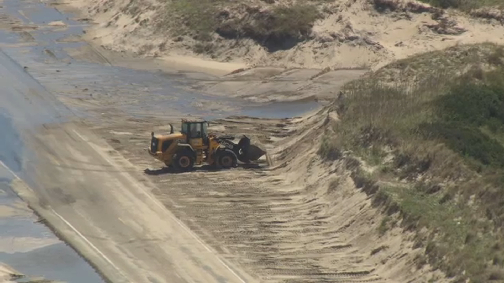
NC 12 was greatly impacted, leading to the closure of the highway indefinitely.
Dangerous rip currents created by the storm led many beaches to warn against swimming.
Dare County deploys assessment team to Hatteras Island
Dare County remains under a State of Emergency, which includes the mandatory evacuation of Hatteras Island.
Friday, the Dare County damage assessment teams were deployed to Hatteras Island. The team is conducting a post-storm damage assessment to determine the severity of the impact of Erin on the community.
The assessment will include checking on homes, businesses, and public infrastructure to help with their recovery plan.
This will also help them ask for state or federal assistance if needed.
This is also a reminder that once the island reopens, you'll need a reentry permit, the county announced on Thursday.
Click on Dare County to get more details on the process and apply for a reentry permit.
Double red flags are posted Friday for ocean beaches. No one is allowed in the water.
"Motorists should use caution at dune access ramps where erosion has occurred, and some sections of the beach driving area may be impassable or have limited driving lanes during high tides," the county said.
Hyde County has also lifted its evacuation order for residents, property owners and essential personnel on Ocracoke Island effective at noon.
Visitors are still not allowed to travel Highway 12 at the north end of Ocracoke due to constant ocean overwash and sand accumulation. Hyde County officials said NCDOT is still working to clear that part of the highway and resume access.
Aug 22, 2025, 3:43 PM GMT
Pamlico Sound Ferry routes reopen after Hurricane Erin
North Carolina Department of Transportation's Ferry Division has resumed service to Ocracoke from Swan Quarter and Cedar Island.
This follows the lifting of Hyde County's evacuation order due to Hurricane Erin.
Visitors are still not allowed to access Ocracoke Island, according to NCDOT.
The ferry schedule August 22, is as follows:
Swan Quarter - Ocracoke: Noon and 4 p.m. Ocracoke - Swan Quarter: Noon and 4 p.m. Cedar Island - Ocracoke: Noon and 4 p.m. Ocracoke - Cedar Island: Noon and 4 p.m.
Both routes resume their regular summer schedules tomorrow.
Service remains suspended on the Hatteras-Ocracoke route, as N.C. 12 is closed between the ferry terminal and the National Park Service Pony Pens.
Aug 22, 2025, 11:34 AM GMT
Erin now Cat. 1 hurricane; Dare Co. manager says 'hopefully worst of it is behind us'
The National Hurricane Center in Miami reported Friday that Erin had weakened to a Category 1 hurricane, with maximum sustained winds of 90 mph (150 kph), and was located about 490 miles (785 kilometers) south-southwest of Halifax, Novia Scotia.
Despite being twice the size of an average hurricane, Erin so far has managed to thread the needle through the Atlantic between the East Coast and several island nations, limiting its destructiveness.
The Outer Banks waves breached dunes in the town of Kill Devil Hills Thursday evening, and water and sand pooled on Highway 12. Although damage assessments were still underway, the low-lying islands appeared to have dodged widespread trouble.
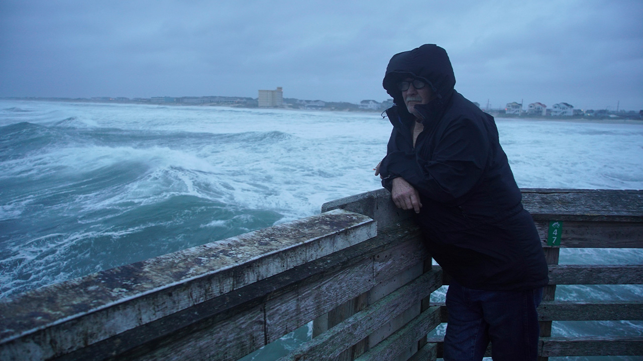
A man smokes a cigarette at the end of Jennette's Pier as waves from Hurricane Erin crash ashore in Nags Head, N.C., on Thursday, Aug. 21, 2025
A tropical storm warning remained active on Bermuda, where residents and tourists were told to stay out of the water through Friday. But warnings along the coasts of North Carolina and Virginia were discontinued. Communities along the mid-Atlantic and southern New England coast could see tropical storm-force wind gusts through early Friday, according to the National Hurricane Center in Miami.
The Outer Banks - essentially sand dunes sticking out of the ocean a few feet above sea level - are vulnerable to erosion. Storm surges can cut through them, washing tons of sand and debris onto roads and sometimes breaking up pavement and creating new inlets.
The dunes and beach took a beating the last two days, but Dare County Manager Bobby Outten said there have been no new inlets with Erin or significant structural damage to homes or businesses.
"All in all it's not as bad as it could have been," Outten said. "Hopefully the worst of it is behind us."
Sebastian Kettner fishes on Jennette's Pier as waves from Hurricane Erin crash ashore in Nags Head, N.C., Thursday, Aug. 21, 2025.
On Jennette's Pier in Nags Head, where sustained winds reached 45 mph (72 kph), dozens of onlookers snapped photos of the huge waves crashing into the structure amid driving rain.
"This is nature at her best," Nags Head resident David Alan Harvey said. "I love this. I love these storms."
Erin has fluctuated in intensity since forming nearly a week ago but remained unusually large, stretching across more than 600 miles (965 kilometers).