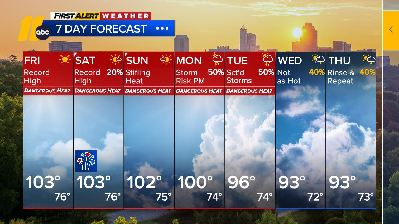
Rain main culprit before Christmas, snow flakes possible with dangerous cold


RALEIGH, N.C. (WTVD) -- The second half of this week is when the quiet weather pattern likely shifts gears. A system will move into the Carolinas overnight Wednesday into Thursday ahead of strengthening low pressure in the Midwest and central Plains.
Most of the precipitation moving in should arrive as rain; however, initial timing could lead to a brief period of sleet and/or freezing rain mainly in the far western Piedmont before a changing back over to rain.
Friday looks to be the worst day of the week once the low pressure finally sweeps into the Northeast. Heavy rain will be possible during this storm, and a rapid changeover to snow will be possible as well, as strong winds are expected to rush over the region. Thursday and Friday should turn out to be an overall milder day despite the rain.
EXPLAINER: Weather models vs weather forecast for this snow event
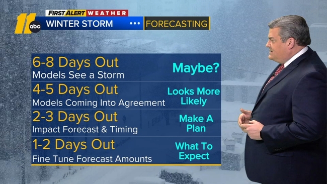
Right now, it is too early to pinpoint exact precipitation totals given the uncertainty of the timing and intensity of this storm. Travel delays during the upcoming period leading right up to Christmas should be anticipated.
Much colder air will funnel into the viewing area overnight Friday into Saturday.
The upcoming weekend should overall be dry, yet quite cold and brisk in the wake of this storm. Highs in the 30s look likely for the Christmas holiday weekend.