Unsettled pattern to start the work week

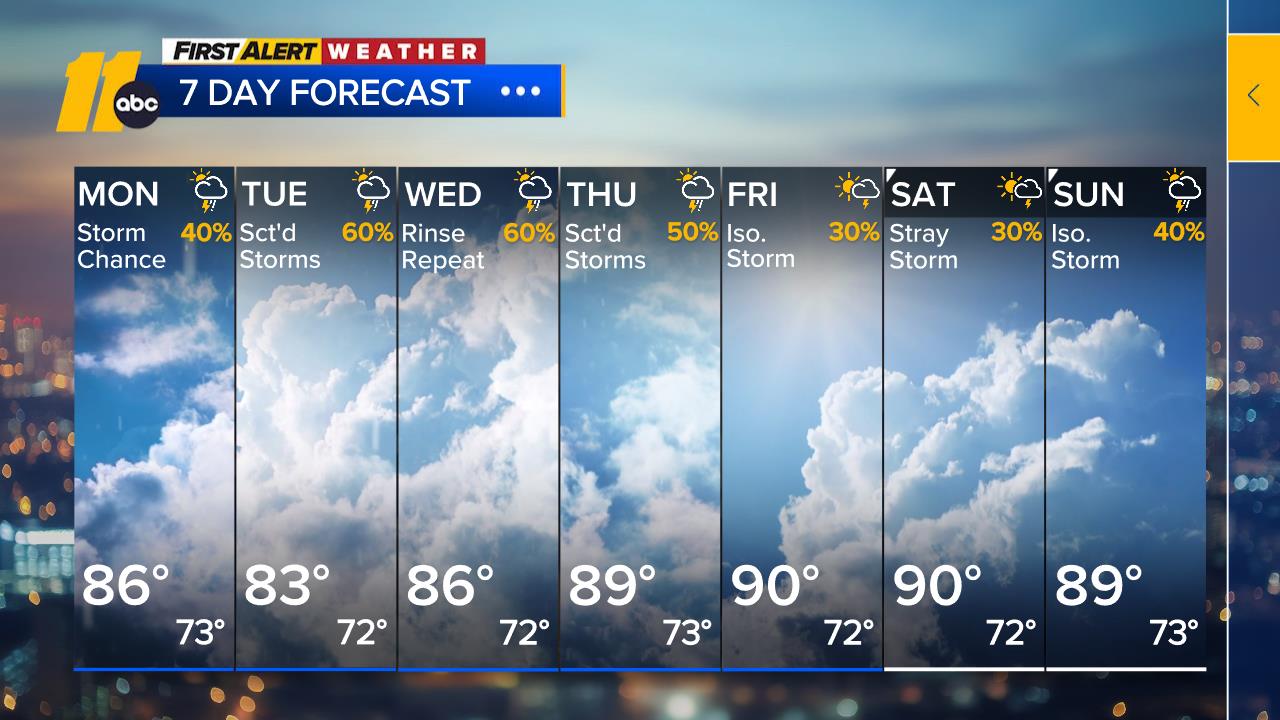
RALEIGH, N.C. (WTVD) -- First Alert Forecast: More showers are storms are expected through the middle of the week. A low-end flood risk exists through Wednesday.
A few showers and storms remain possible overnight. Lows will only drop into the 70s so expect a warm and muggy start to your Monday.
Monday will start off warm and mostly cloudy. Afternoon highs will top out in the mid 80s, and isolated late-afternoon and evening storms will be possible.
The overall upper-level weather pattern will remain favorable for daily storm chances through at least midweek. With plenty of moisture in the atmosphere, any storm will be capable of producing heavy downpours. Because of that, the Weather Prediction Center continues to highlight a low-end flash flood threat from today through Wednesday.
Rain and storm coverage should begin to decrease later this week. High temperatures will climb back near 90, which is right on par with what we typically see in early August.
The tropics remain quiet, with no development expected over the next seven days.
Have a great week!
Cruz Medina