Record highs expected as heatwave continues across NC

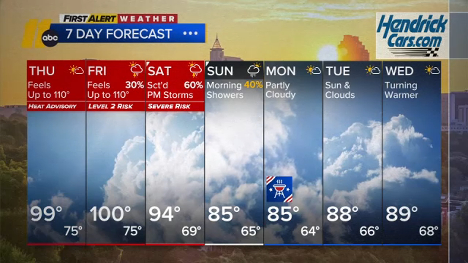
RALEIGH, N.C. (WTVD) -- First Alert Day-Dangerous Heat: High heat and humidity will last through Friday. Expect highs in the mid-to-upper 90s with heat indices of 100 to 110 each day. A Heat Advisory is in effect through 8:00 p.m.
So far this afternoon, RDU has tied its record high of 99. Highs could still rise. Evening temperatures will stay very hot. Overnight lows will be in the 70s.
CLICK HERE FOR LATEST SEVERE WEATHER ALERTS
Anyone with outdoor plans through Friday should prepare for the heat, with feels-like temps of 100 to 110 degrees in the afternoons. Overnight temperatures will remain in the mid-70s, bringing little relief from the heat, with conditions more akin to the peak of summer.
The heat will persist through Friday as high pressure continues to build overhead. The ridge shifts west by the weekend, which will start to chip at temperatures starting Saturday.
A few storms will be possible late Friday afternoon and Friday night. These storms will be capable of hail and damaging wind. A similar risk could be present Saturday as well, especially depending on the timing of the incoming cold front.
Most activity should be south of the area by Sunday afternoon, which will bring more comfortable conditions to close out the holiday weekend compared to the hot and wet start. The day could start cloudy on Sunday with showers and storms, but by the afternoon, some clearing looks likely, and there will be intermittent sunshine. Sunday will also end up near, or just below, the historical average in terms of temperatures.


By next week, there is a chance that the upper ridge nudges back eastward, which could again feature drier and warmer conditions for the region, although there is still some differences among models as to amplitude and eastern/western extent of this ridge.
Have a great evening!
Cruz Medina