Hot & humid end to the week, weekend storms possible

RALEIGH, N.C. (WTVD) -- Ridge of high pressure remains the dominant weather feature across the region. That means it will be another warm and humid overnight.
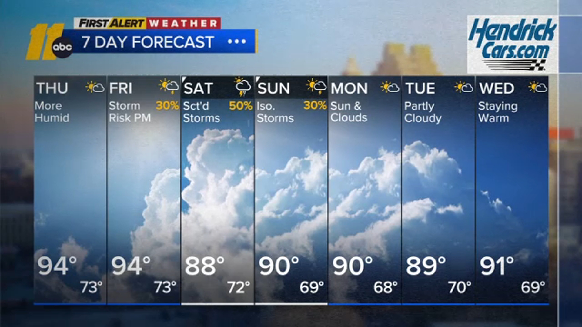
Energy aloft moving into the Ohio Valley tomorrow will push the ridge east. At the surface, a front will push in from the northwest. With instability, as surface CAPE nears 1600 J/kg, and plenty of moisture, there can be a spotty afternoon and evening thunderstorm. Thunderstorms could produce localized gusty winds.
The front stalls over the region tomorrow night, then retreats northward on Saturday. A trough also swings through the Tennessee Valley on Saturday. This will allow for a better opportunity for thunderstorms. With PWATs slightly over 2 inches, there can be localized flash flooding and once again gusty winds.
Heights come back up on Sunday as a ridge builds once again across the Southeast into the early part of next week. With some lingering energy aloft, there can be a spotty thunderstorm around Sunday, especially during the afternoon. Dry and hot conditions then return for early next week.
Have a great evening!
Big Weather