Heavy rain, nasty storms possible Thursday for much of North Carolina


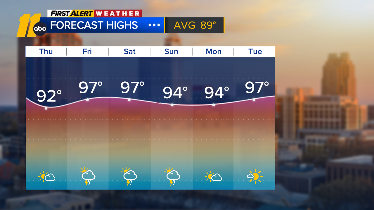
It's warm out there. VERY warm.
Yesterday, in Phoenix, Arizona, the temperature was 65. In the Triangle, we topped out at 74. Fayetteville hit 75.
The problem is we have to go from these nice warm temps today back to typical highs in the 50s by the weekend and, to get there, we have to go through some nasty weather Thursday.
First, let's look at the risk of severe weather. Over 42 million people in the U.S. are under some sort of risk for Thursday into early Friday. The risk bubble touches every county in the ABC 11 viewing area.
The biggest threat comes from damaging winds, right now. As we get closer to the onset of the storms, and get a better idea of the timing, we'll be able to narrow down the risk area. We will also have a better idea if those winds will be straight-line or associated with a tornado risk.
Now, let's talk about the rainfall potential.
This is the American model, the GFS. It's showing some significant rainfall totals, especially in the mountains. Now, this is ONE model and not a forecast. As a matter of fact, our in-house model shows lower amounts. It does give us a heads up though that the potential is there to see SIGNIFICANT rainfall.
The National Weather Service in Raleigh even discussed the possibility of major flooding along a couple of rivers in our area, specifically the Haw at Haw River and the Neuse at Smithfield. No watches or warnings have been issued, but it is something to keep an eye out for in the coming days.
Bottom line = a stormy afternoon is possible Thursday. We'll get a better idea as we get closer to it.
By the way, if you don't have the ABC11 app, you may want to download it. We'll fire out warnings as they come in.
Stay weather aware!