Warming Up

RALEIGH, N.C. (WTVD) -- The first six days of September in Raleigh are ranked as the warmest start to September since records began with an average temperature of 85.3 degrees. 1921 is in second place with an average temperature of 83.3 degrees.
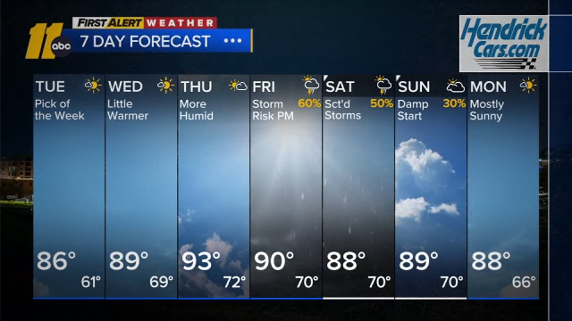
Surface and upper-level ridging will remain intact across the Carolinas through Wednesday. During the time period from Tuesday night into Wednesday, the surface flow backs around to the southeast-south and eventually southwest, helping to move in higher dew points.
An upper trough will be pushing through the Ohio Valley on Thursday. We will be on the northern periphery of an upper ridge and ahead of the trough, so late in the afternoon a thunderstorm or two will develop in a few spots.
For Friday through the weekend, our region will be under a decaying upper level ridge with short waves cresting the ridge across the Ohio Valley. This will keep us in warm and humid environment with a thunderstorm in spots. None of the rain looks organized but given the strong winds aloft, there could be a gusty storm on Friday, Saturday and Sunday.
Have a great rest of your Labor Day!
Big Weather