First Alert Day: Heavy rain, storms could bring flooding Friday

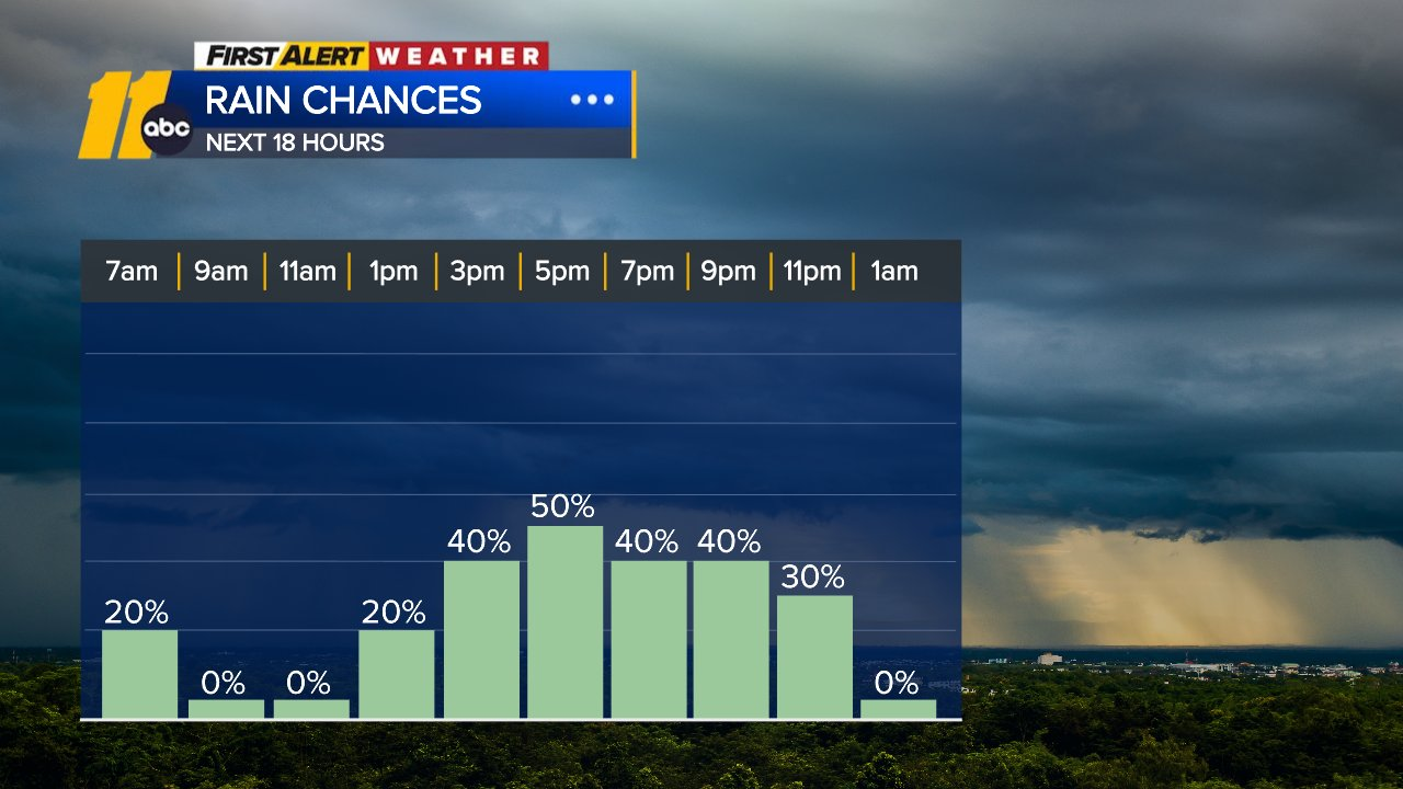
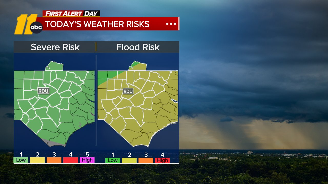
RALEIGH, N.C. (WTVD) -- First Alert Day-Friday: Thunderstorms today will bring periods of heavy rain, which could lead to a risk of localized flooding. There is also a Level 1 of 5 risk of isolated strong to severe storms. Damaging winds will be the primary threat.
Good Friday morning! The unsettled pattern continues today through Sunday as a front stalls over the region. The best chances for showers and storms will be this afternoon through the evening.
Thunderstorm chances continue through the weekend as the front slowly passes, ultimately pushing to the coast by Sunday afternoon.
Rainfall totals through the weekend look to be a general 0.5-1.5 inches, with locally higher amounts where the heaviest downpours occur and in locations that receive multiple rounds of rainfall. Some guidance suggests localized totals up to 5 inches are not out of the question. The risk for flash flooding decreases through the weekend as the front moves off to the east, though flash flooding can still occur in heavier and more persistent downpours, especially in areas that have received multiple rounds of downpours through the weekend.
Highs will be in the mid to upper 80s today through Sunday.
A strong ridge of high pressure will build over the eastern U.S. early next week. This will result in highs in the 90s and feels-like temps as high as 108. When the ridge breaks down later in the week, there will be a chance for a few showers and storms.


Tropical Storm Dolly
Dolly is moving quickly toward the west near 24 mph (39 km/h) and this motion is expected to continue for the next couple of days. On the forecast track, this system, or its remnants, should be nearing the Leeward Islands this weekend. Maximum sustained winds remain near 40 mph (65 km/h) with higher gusts. Little change in strength is likely during the next couple of days, and Dolly is forecast to degenerate into a tropical wave before it reaches the Leeward Islands. Tropical-storm-force winds extend outward up to 115 miles (185 km) north of the center.
RAINFALL: Heavy rain from Dolly could affect the Leeward Islands late Saturday into Sunday, with rainfall moving into the Virgin Islands, Puerto Rico and Hispaniola Sunday and Monday. This heavy rain may produce flash flooding within areas of higher terrain of the Leeward Islands.
Have a great day!
Kweilyn