Early September heatwave grips Central NC

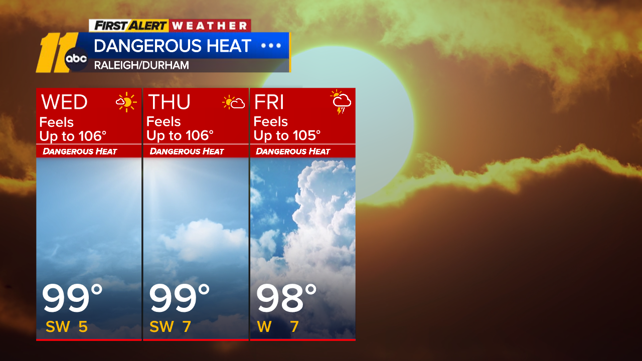
RALEIGH, N.C. (WTVD) -- First Alert-Dangerous Heat: High heat and humidity will return Tuesday and last through Friday. Expect highs in the mid to upper 90s with heat indices of 100 to 110 each day.
It's been a hot day across Central NC and very warm temperatures will stick around this evening. Lows will be around 70 degrees tonight.
Tuesday is the official start of the heatwave as we start the month of September. Highs will top out in the mid 90s, with feels-like temperatures exceeding 100 degrees.
Record high temperatures will be challenged Wednesday and Thursday as the core of upper-level high pressure settles overhead. The forecast high for each of those days for RDU is 99. The standing record high for each of those days is also 99.
Late in the week, a cold front moving in from the north will likely cool us down, but also brings a storm threat late in the day on Friday and again on Saturday. Highs will drop into the 90s by Friday.
Temperatures will return closer to the historical average of 85 degrees as we head into Labor Day weekend, with some guidance suggesting humidity could drop for the holiday.
Tropics: For the North Atlantic...Caribbean Sea and the Gulf:
1. Tropical Depression Five
The system is moving toward the
west-northwest near 5 mph (7 km/h), and this general motion is
expected to continue for the next day or two. On the forecast track,
the center of the system is predicted to reach the northwestern Gulf
Coast within the warning area on Tuesday. Data from the Air Force Hurricane Hunters indicate that maximum
sustained winds are near 35 mph (55 km/h) with higher gusts. Some
strengthening is expected during the next day or so, and the
system is forecast to become a tropical storm by tonight.
Have a great evening!
Cruz Medina