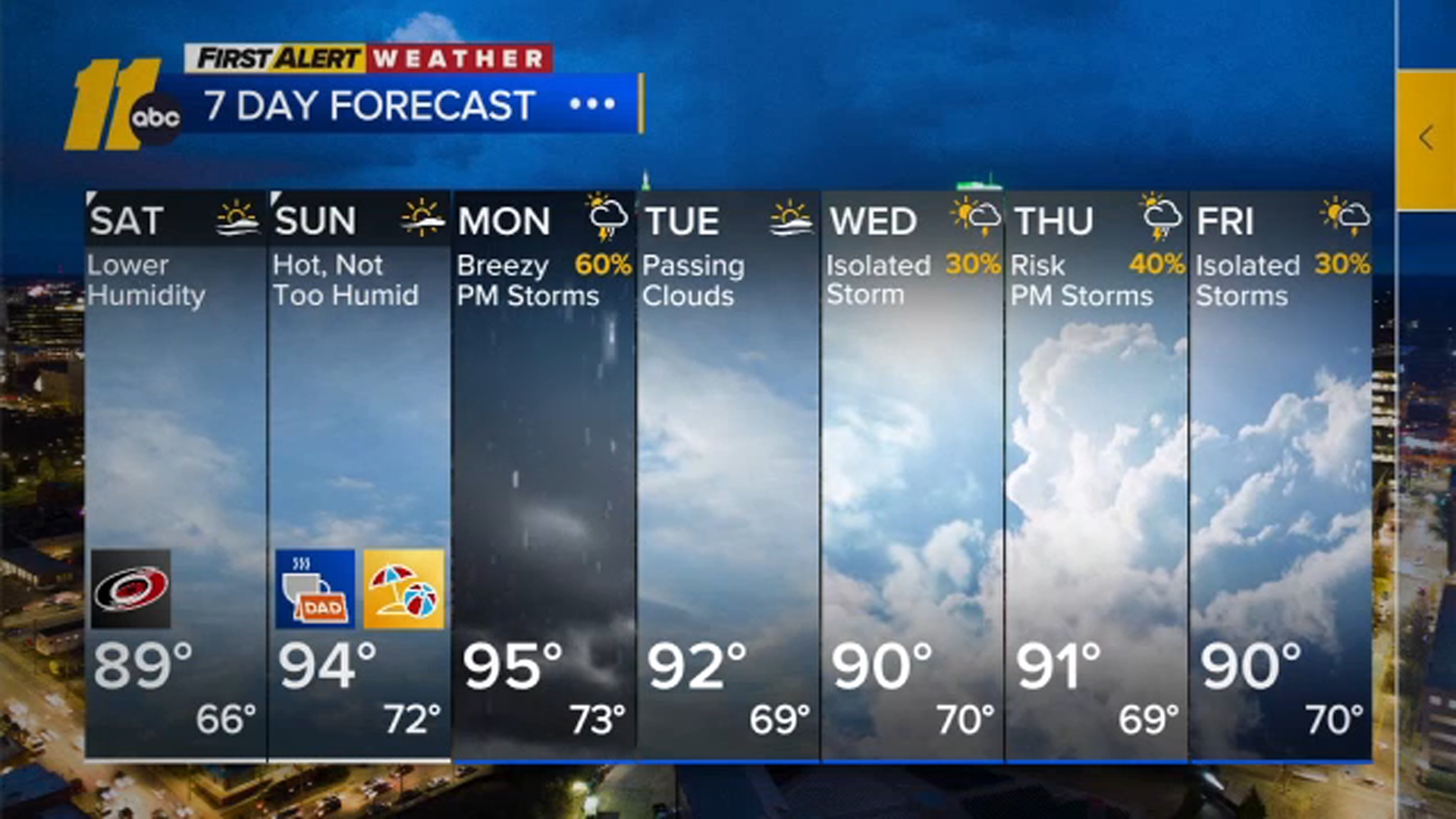
Warm weather to continue through the weekend


RALEIGH (WTVD) -- A large ridge of high pressure centered off the East Coast will provide Central North Carolina with a very mild Christmas Day.
Click here for First Alert Doppler XP
Click here to download the ABC11 First Alert Weather app.
In Raleigh, high temperatures will approach the record high for the day, which is 75, set back in 1955. Skies will be rather cloudy. There will be a stray shower or two, though most of the holiday will turn out dry.
The weather doesn't change over the holiday weekend.
Saturday and Sunday will feature clouds most of the time along with a shower or two, though the majority of the shower activity will end up north of the Virginia border. The high moisture content will lead to areas of fog during the late night and morning hours. Some areas will experience fog that could be locally dense. Otherwise, there won't be any big weather hazards, just unseasonably warm weather. As a matter of fact, our high on Saturday will break the old record high of 75 set back in 1889!
A weak cold front will move in from the north on Sunday night and Monday, bringing cooler air and thicker clouds. This front will bring some sprinkles and showers on Sunday night into Monday, though the heaviest and steadiest rainfall will end up northwest of the Triangle.
A more significant cold front will move into the region by the middle of next week with the chance for more showers and a cooler New Year's Eve.