A 'once in a generation' winter storm will impact nearly every state and cripple Christmas travel


A major winter storm and cold blast will impact nearly every state and bring what the National Weather Service is calling a "once in a generation type event" that will cripple travel on some of the busiest travel days of the year.
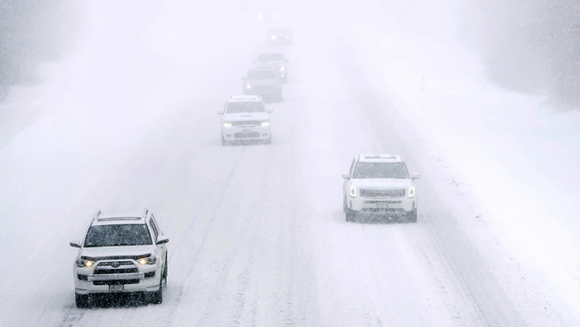
The strengthening storm will bring more than a foot of snow and possible blizzard conditions to the Midwest, as the weather service warns of "life-threatening" wind chills for millions.
More than 90 million people are under winter weather alerts and more than 87 million are under wind chill alerts. The alerts stretch across 37 states, dipping as far south as the Texas/Mexico border.
The cold will stick around for Christmas weekend, making this the coldest Christmas in roughly 40 years for portions of the Plains and Midwest.
RELATED: 'Bomb cyclone': What to know about this kind of monster storm
Storm timeline:
Wednesday: The storm will strengthen over the Northern Plains through the day as heavy snow falls across much of the Rockies, the Northern Plains and into the Midwest. Slick roads will lead to travel headaches and airport delays through places like Minneapolis, Omaha and Rapid City.
This system will bring 5 to 9 inches of light fluffy snow across the region, with "the highest amounts just north and west of the Twin Cities," said the weather service office in Twin Cities. While snow will steadily fall across the region, the high winds won't kick in until Thursday.
Denver will go from a high of 47 on Wednesday to a low of minus 14 on Thursday morning. That would be the city's coldest day in 32 years, according to the weather service.
Thursday: Thursday will be the most difficult day for travel. The storm will be hitting the Midwest extremely hard with heavy snow and strong winds. Western Minnesota will face not only blizzard conditions, but potentially deadly wind chills Thursday and Friday.
"Whiteout conditions are expected during that time with travel becoming very difficult or impossible," said the weather service. "This event could be life-threatening if you are stranded with wind chills in the 30 below to 45 below zero range."
RELATED: Airlines issue travel waivers ahead of massive 'bomb cyclone' of wintry weather
Chicago could also face blizzard conditions with winds gusting as high as 50 mph, with 2 to 4 inches of snow forecast.
"Overall, concern continues to increase in the quick development of dangerous conditions Thursday afternoon with potentially significant impacts to the evening peak travel window," warned the weather service office in Chicago.
Additionally, strong winds may knock out power lines in the Midwest, especially in areas where heavy snow fell last week and is already weighing down tree branches. This will leave millions finding a way to stay warm as temperatures plummet to well below freezing.
Snow could fall as far south as Jackson, Mississippi, Memphis and Nashville in Tennessee and even Birmingham, Alabama, on Thursday. Little to no accumulation is expected for most of the southern cities, however, Nashville could pick up about an inch of snow.
MORE: What can I do if my flight is canceled, delayed? How to prepare for likely 2022 holiday travel mess
In anticipation of what will be a week of travel nightmares, United, American, Delta, Southwest and Jet Blue have issued travel waivers for dozens of airports across the country from the South to the Northeast, because in addition to snow covering roadways, low visibility could make air travel dangerous.
Friday: The storm is expected to become a "bomb cyclone" Thursday evening into Friday. A bomb cyclone is when a storm rapidly intensifies -- and drops 24 millibars (a term used to measure atmospheric pressure) in 24 hours.
The storm is expected to reach the pressure equivalent of a Category 3 hurricane as it reaches the Great Lakes, with the weather service describing the strength of the low a "once-in-a-generation" event.
"This is a case in which snow totals may not tell the whole story. Even small snow amounts, when combined with very strong wind gusts and plummeting temperatures, can cause poor visibility and slick spots on roads. The sudden arrival of these conditions can increase the danger," the weather service explained.
MORE: How to make sure you don't lose track of your luggage this holiday
The storm will be over the Great Lakes on Friday and continuing to produce heavy snow across much of the Midwest. Portions of Michigan could pick up more than a foot of snow by Friday, making travel impossible at times.
Heavy rain will also blanket much of the I-95 corridor, adding to the travel troubles and lengthy airport delays.
Even in places where the snow has ended, strong winds will continue to blow 30 to 40 mph across much of the Midwest and into the Northeast.
Friday night into Saturday morning, New England will get a quick shot of snow and windy conditions.
MORE: TSA trying out facial recognition system at several new airports
Life-threatening cold
Places that will escape the snow, won't escape the cold. Areas from eastern Montana through the Dakotas will experience the coldest air beginning Thursday morning. Temperatures will be running 40 degrees below normal for these places. The combination of cold temperatures and windy conditions will send wind chills as low as 50 degrees below zero.
Rapid City will feel like 45 degrees below zero on Thursday morning. By Friday morning, Chicago's wind chill will bottom out at 30 degrees below zero.
MORE: LIST: Here are the Lake Tahoe ski resorts now open for the 2022-23 season
"The dangerously cold wind chills could cause frostbite on exposed skin in as little as 5 minutes," warned the weather service office in Bismarck.
Even the South will be dangerously cold. Nashville and Atlanta's wind chill will drop to minus 11 on Saturday morning and Birmingham will feel like minus 5.
Jackson and Birmingham will both spend more than 80 hours below freezing between Friday and Monday. Houston could sit below freezing for 46 hours between Thursday and Saturday.
The cold temperatures will stay through Christmas weekend, before finally moderating next week.
The-CNN-Wire
& 2022 Cable News Network, Inc., a Warner Bros. Discovery Company. All rights reserved.