Winter storm hits Central North Carolina, bringing ice and sleet

WTVD logo
Last updated: Thursday, January 29, 2026 10:53AM GMT
NC Winter Storm

RALEIGH, N.C. (WTVD) -- Several weather alerts, including a Winter Storm Warning, remain in effect until Monday afternoon.

Download the ABC11 App for breaking news alerts and weather alerts

Saturday night, in Central NC, moderate to heavy mixed precipitation, mainly sleet and freezing rain started falling.

WATCH: Winter Weather Special

Your guide for making sure you are prepared for inclement weather as another winter storm approaches.

Most people awoke Sunday to the roads covered with the wintry mix.

Roads, especially bridges and overpasses, remain slick and hazardous.

Duke Energy had 18,000 workers staged across the Carolinas to respond to power outages.

Most school districts across central NC have already made decisions about how to handle Monday's snow day.

WTVD logo
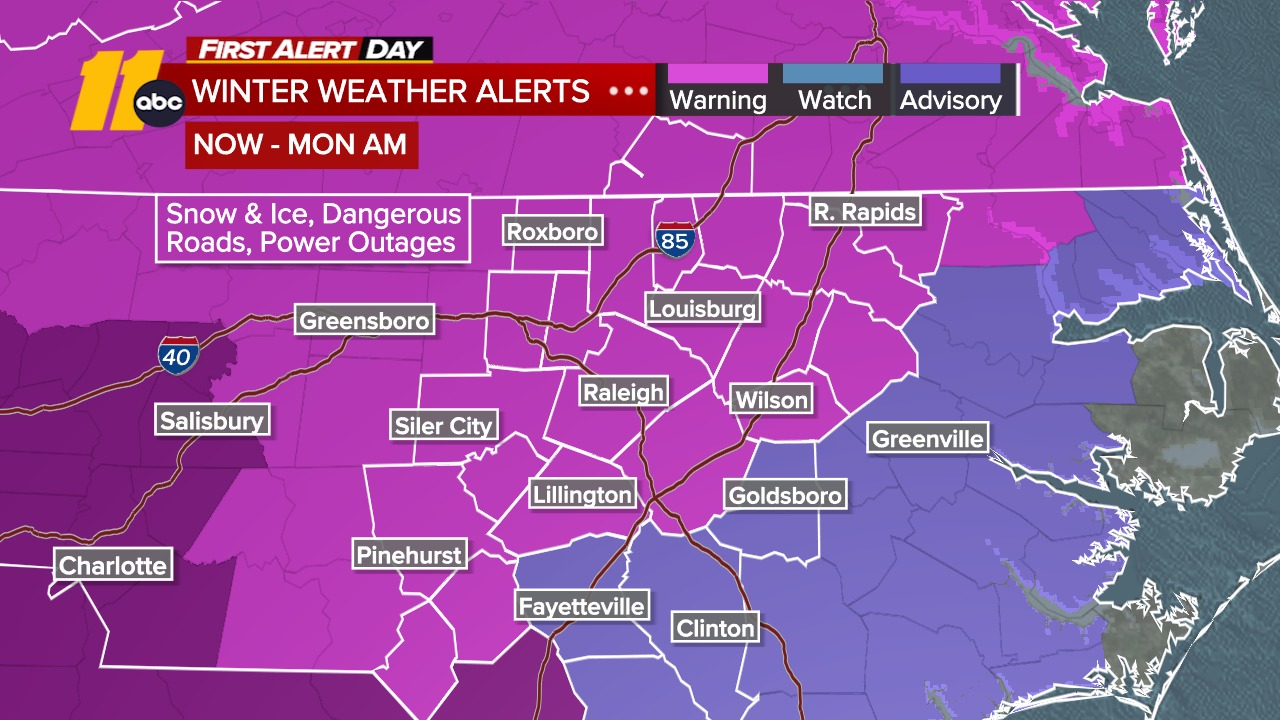
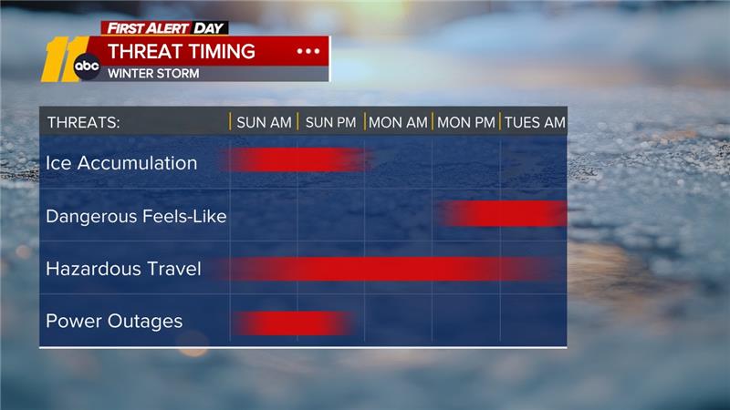
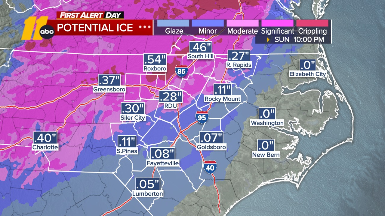
Jan 25, 2026, 2:15 PM GMT

Power outages reported in southern Wake County

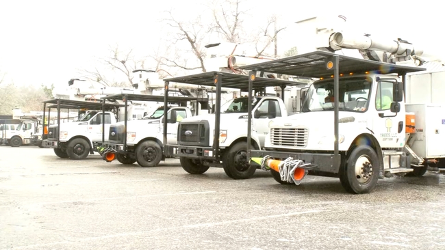
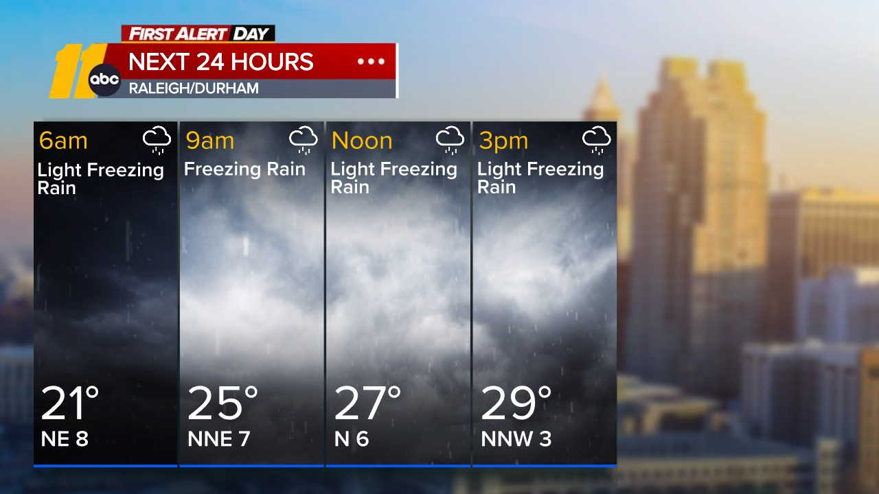
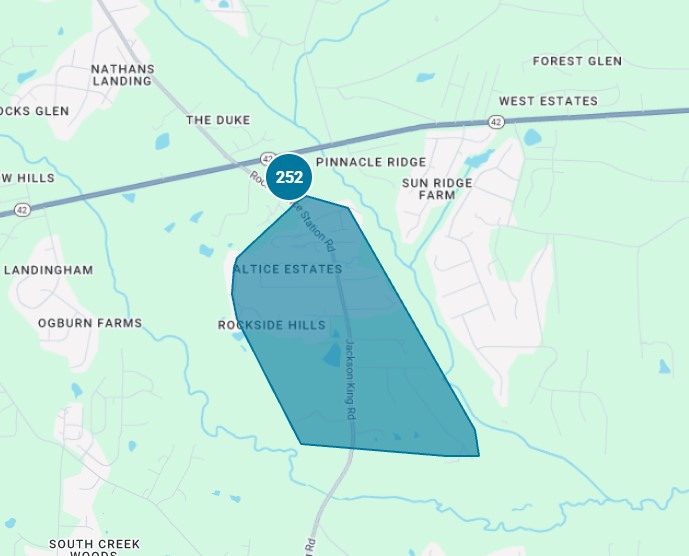
Over 200 people are without power on Rock Service Station Road near Fuquay-Varina, according to the Duke Energy power outage.

There is no estimated time of restoration. Duke Energy said they are waiting for the storm to clear the area.

WATCH | Duke Energy's Jeff Brooks talks power outages

WTVD logo
Jan 25, 2026, 12:08 PM GMT

What to expect in the next 24 hours: ice, power outages

Here is a map showing the current weather alerts in effect and the predicted timing of threats such as ice accumulation, dangerous feels-like temperatures, hazardous travel, and power outages across central NC.

ABCNews logo
Jan 25, 2026, 10:54 AM GMT

Sunday to be one of the worst travel days

Sunday will go down as one of the days with the most weather-related flight cancellations in U.S. aviation history with more than 8,000 flights already canceled.

American Airlines has cancelled 37% of its total flights. About 85% of flights at LaGuardia are already cancelled.

-- ABC News' Sam Sweeney

WTVD logo
Jan 25, 2026, 10:20 AM GMT

Winter weather brings sleet, snow, freezing rain with bitter cold ahead

Sleet and snow are falling Sunday morning, particularly in the northern and eastern parts of the Triangle.

The transition to freezing rain is occurring in the Sandhills and is expected to reach the Triangle shortly.

Looking ahead

A lull is likely into early afternoon before a final west-to-east burst of rain or freezing rain. This burst may include elevated wind gusts, increasing the risk of outages due to ice on trees.

Bitter cold will persist through the end of next week, with highs in the 20s and 30s, single-digit feels at night, and teens during the day. Monday night and Tuesday morning will be the coldest, with some daytime melting possible early in the week.