NC Weather: Remnants of Hurricane Ida create level 2 risk for severe weather today


RALEIGH, N.C. (WTVD) -- Ida, significantly weakened since making landfall in Louisiana on Sunday, is bringing a chance for severe weather to North Carolina on Wednesday.
Most of central North Carolina was under a level two risk of severe weather up until Wednesday afternoon. The latest update from the Storm Prediction Center has the level two risk now confined to just the Coastal Plain and areas east.
Damaging wind gusts are still the main threat with Wednesday's storms, but isolated tornadoes and flooding are also possible in some areas.
TIMING
The first effects of Ida arrived in the form of rain in the North Carolina mountains Tuesday night. Clouds also continued to build across the state late Tuesday night into Wednesday.
The storms will not begin in central North Carolina until about noon Wednesday.
Scattered storms will be possible throughout the region from noon until midnight. Some of those storms could turn severe or even spawn a tornado
By sunrise Thursday, the storms should have made their way out of the area--although some scattered storms may still remain along the coast.
The isolated strong storms are not expected to blanket the region with torrential rain. All told, areas in central North Carolina should get around .25 - 1 inch of rain. The rain will taper off the farther east you travel in the state.
Steve Stewart breaks down Ida's landfall and the impact
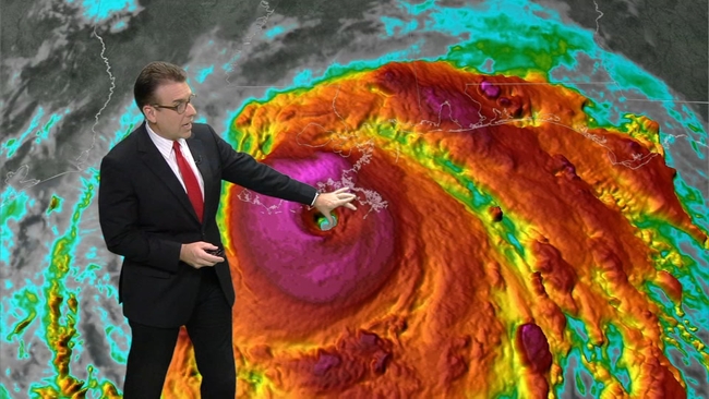
Hurricane Ida by the numbers: Wind speeds, rainfall, storm surges and more
AFTER IDA
In the wake of Wednesday's storms, the weather takes a drastic turn.
Humidity will fall and high temperatures will only reach into the low to mid-80s.
Some people in central North Carolina could wake up Friday to temperatures in the 50s.
Labor Day Weekend is looking exceptional. Temperatures will be in the mid to upper 80s with mostly sunny skies.