Level 2 risk for severe weather: Heavy rain, lightning punctuate stormy day

RALEIGH, N.C. (WTVD) -- Tuesday was a First Alert Day as severe weather moved across central North Carolina into early Wednesday.
The National Weather Service placed part of the ABC11 viewing area in a level 2 risk for severe storms with the remaining area under a level 1 risk.
Numerous counties are under a Severe Thunderstorm Watch until midnight, including Alamance, Chatham, Durham, Edgecombe, Franklin, Granville, Halifax, Nash, Orange, Vance, Wake, Warren, and Wilson
Granville and Person counties are under a Flash Flood Warning until 1 a.m.
A line of storms pushed through parts of the region in the evening. The time between 9 p.m. and 2 a.m. will be peak time for the severe weather.
The biggest threat with those storms is damaging wind and maybe some hail. An isolated tornado can't be ruled out, but the odds remain low for a tornado to spin up.
The areas most at risk of severe weather are in the northwest part of the viewing area, which includes Orange, Durham, Granville, Vance and Person counties.
Storm damage was reported in Person County where trees were down, causing some power outages, Trees reportedly fell around Hyco Lake, which spans parts of Person and Caswell counties.
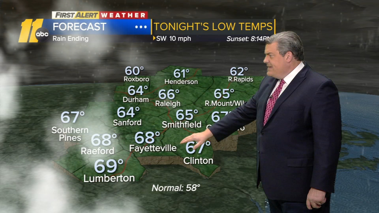
Heavy rain and lightning were seen in Roxboro.
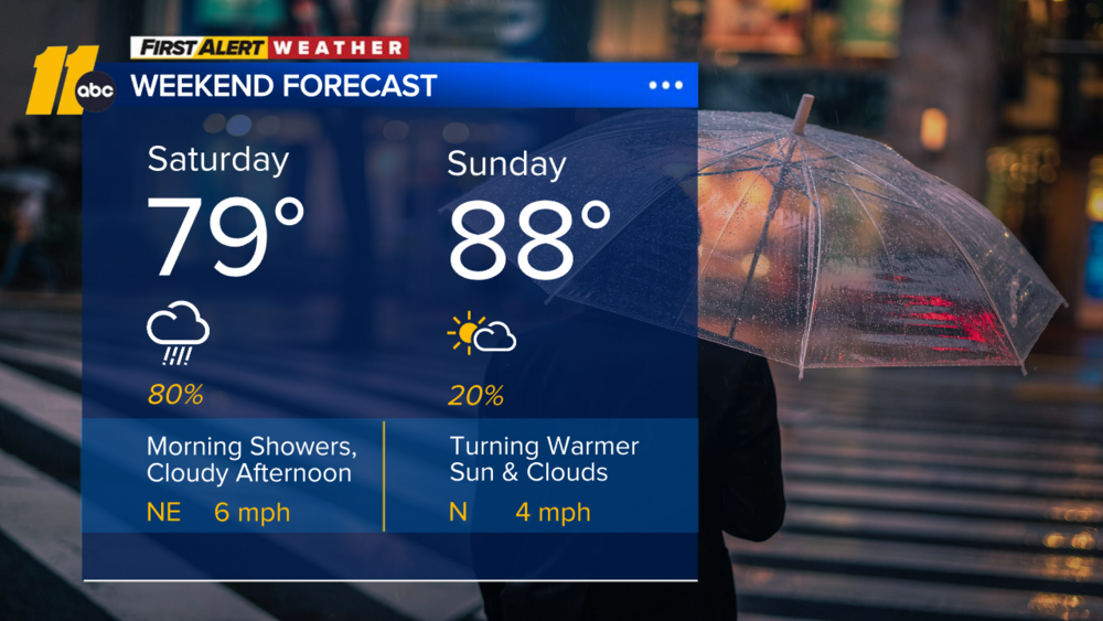
The storms should clear out before the sun rises Wednesday. Expect a mix of clouds and sunshine with temperatures around 80 degrees.
Then Thursday and Friday will see partly cloudy skies with temperatures in the 70s. Looking at the weekend, Saturday will be mainly dry with a possible stray shower but nothing severe,