Snowflakes could follow chilly rain in central NC midweek


DURHAM, N.C. (WTVD) -- There's a lot of chatter online about more snow coming to central NC, so we're letting it be known that outside of some very light snow Wednesday night, this will be mainly a rain event for the region.
An area of low pressure will swing a cold front through on Wednesday. Ahead of the front, a chilly rain is expected on-and-off throughout the day.
Behind the front, very cold air will move in. As this cold air chases the lingering moisture, some wet snowflakes could mix in.
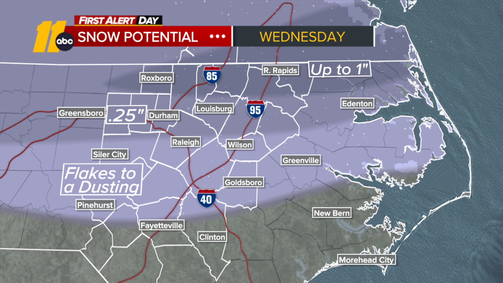
Any accumulations are most likely along the NC/VA border and would be light in nature. Elsewhere, there could be periods of sleet or freezing rain that eventually transitions to light snow showers. Temperatures will fall below freezing on Wednesday night, so icy streets and sidewalks are possible.
No big winter storms are set to impact our region for at least the next 7 days.
Beneficial rainfall is expected between Wednesday and Wednesday night. This rain is welcomed after a prolonged period of drought conditions.