Heat wave begins in Central NC with near-record highs, extreme heat watch


RALEIGH, N.C. (WTVD) -- Click here to stay up-to-date with our weather live blog
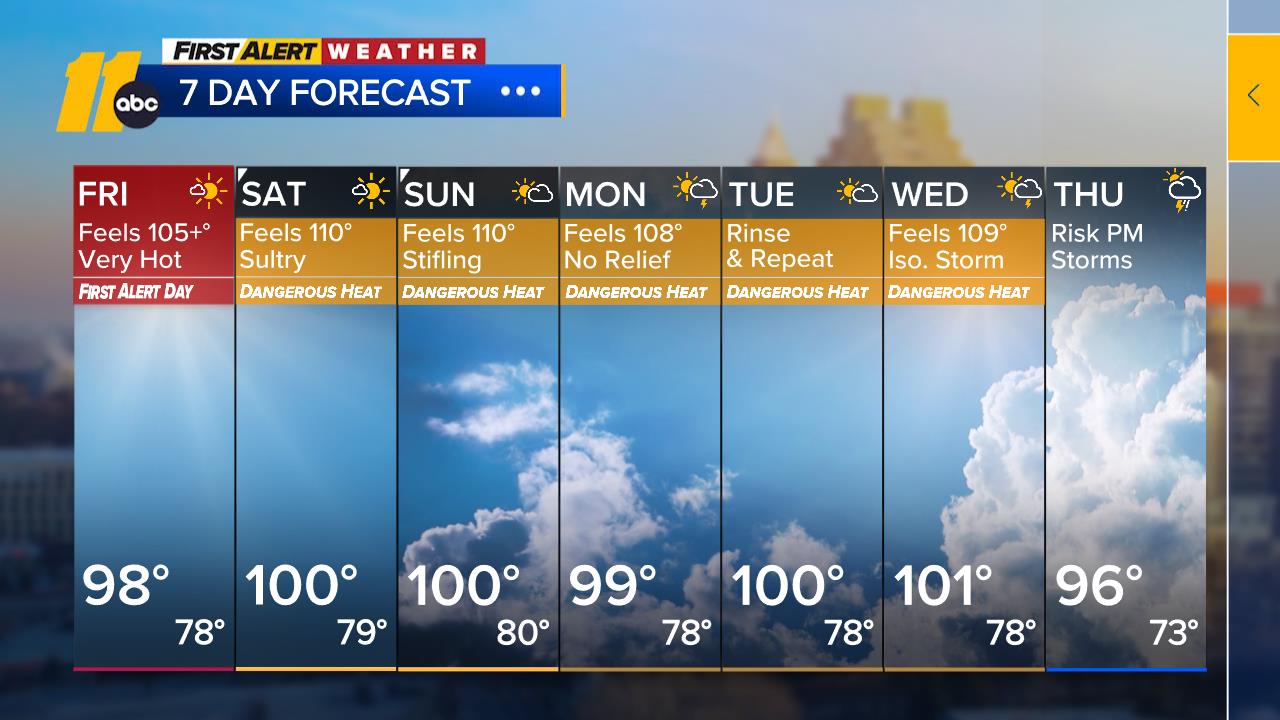
The fourth heat wave of the year kicked off Friday and is set to continue into next week.
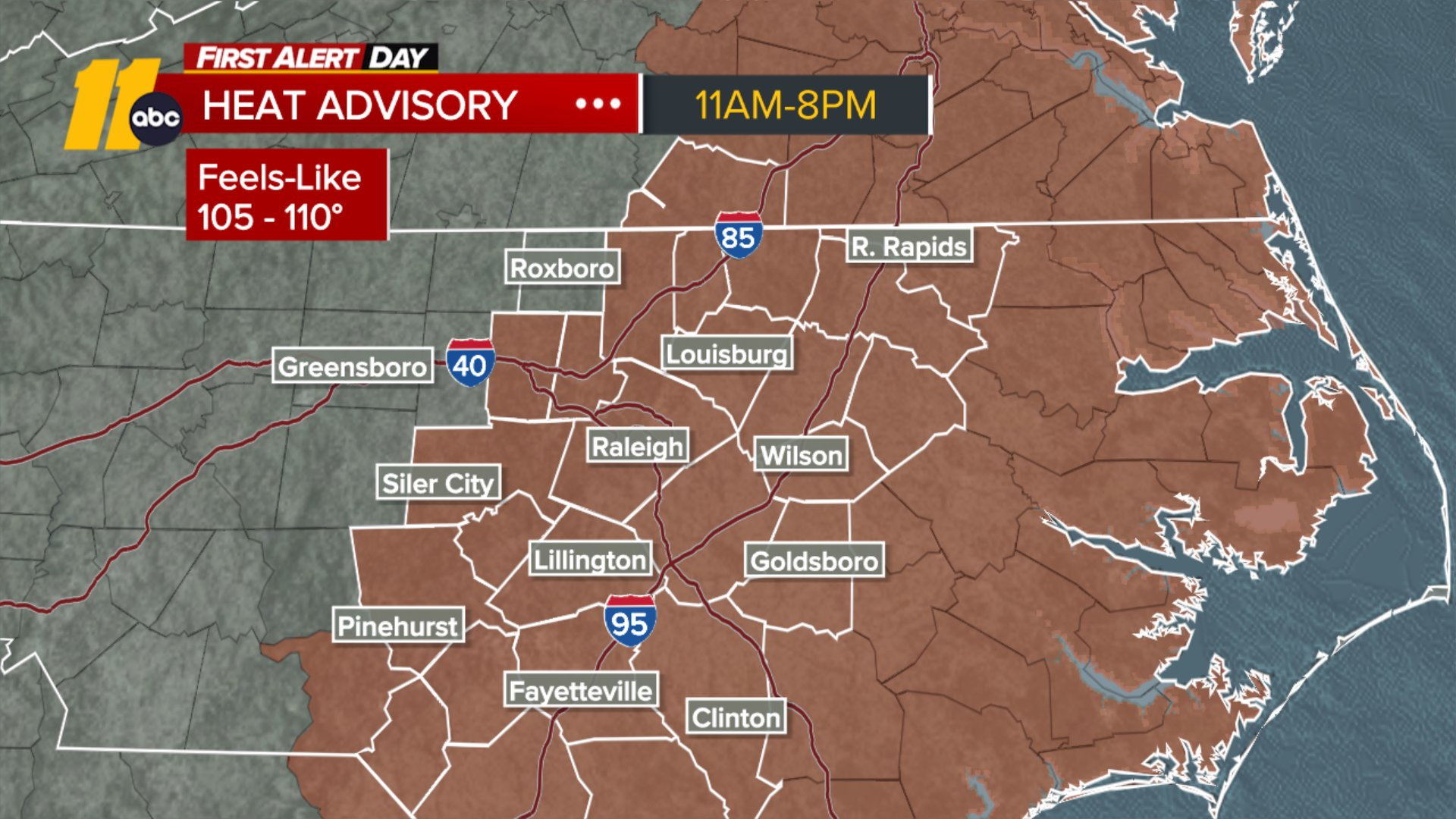
A Heat Advisory is in effect for central North Carolina from 11 a.m. to 8 p.m., with heat index values ranging from 105 to 110. High temperatures will climb to around 100 degrees. High pressure building off the Southeast coast will strengthen the southerly to southwesterly flow, and a slight dip in the ridge could trigger isolated thunderstorms Friday afternoon.
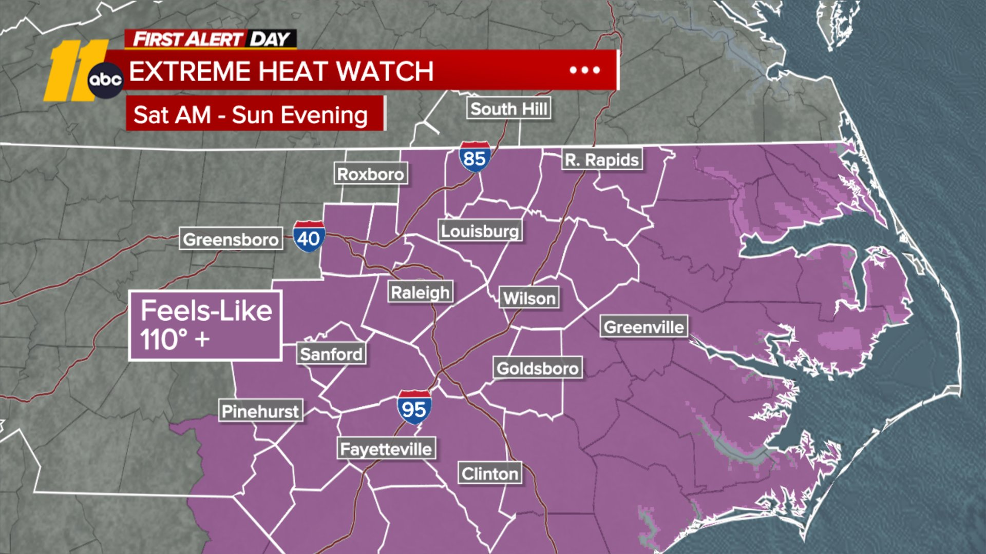
This weekend, near-record highs around 100 degrees are expected, with feels-like temperatures climbing to 105 to 115 or higher. An Extreme Heat Watch is in place from Saturday morning through Sunday evening.
Looking Ahead
Thanks to the strong ridge of high pressure, dry conditions will persist for the next several days, with the forecast remaining mostly dry through midweek.
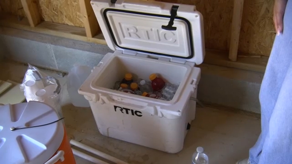
ALSO SEE: Heat Safety Tips: Ways to stay cool during the heat wave