Pop-up storms could bring damaging wind and hail today


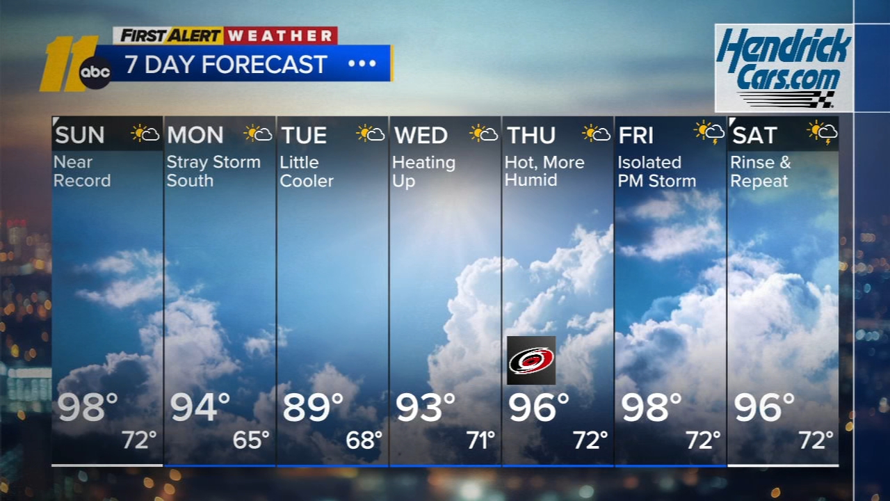
RALEIGH, N.C. (WTVD) -- We're in First Alert Mode as the severe weather risk for much of central North Carolina has been raised to a "slight risk" level 2 for Wednesday.
Any showers and storms that develop Wednesday will be capable of producing damaging winds and hail.
Numerous counties are under a Severe Thunderstorm Watch through 9 p.m., including Wake, Cumberland, Edgecombe, Franklin, Halifax, Harnett, Johnston, Nash, Northampton, Sampson, Wayne and Wilson.
Storms could develop in the late afternoon through early evening.
The focus has been on the heat most of the day, with hot temperatures and high humidity. Afternoon highs in the low 90s will feel more like around 102.
Outside of spotty showers and storms, the area will be dry but storms that do develop could be powerful and bring damage.
Through Friday, we will see the highest feels-like conditions this year and people working or spending time outside should be aware of heat exhaustion.
Heat Safety Tips:
- Drink plenty of fluids
- Stay in an air-conditioned room
- Stay out of the sun
- Check up on relatives and neighbors
- Young children and pets should never be left unattended in vehicles under any circumstances
.
Anyone overcome by heat should be moved to a cool and shaded location. Heatstroke is an emergency! Call 9 1-1.