

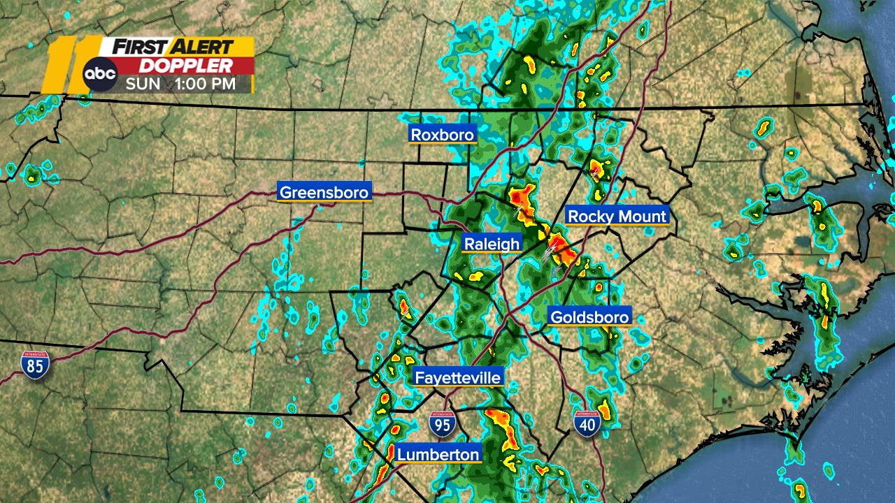
Central NC First Alert Doppler Radar
First Alert Doppler Radar
Show More

- Severe Thunderstorm Watch
SEVERE THUNDERSTORM WATCH 90 REMAINS VALID UNTIL 10 PM EDT THIS EVENING FOR THE FOLLOWING AREAS IN NORTH CAROLINA THIS WATCH INCLUDES 6 COUNTIES IN CENTRAL NORTH CAROLINA EDGECOMBE HALIFAX NASH SAMPSON WAYNE WILSON THIS INCLUDES THE CITIES OF CLINTON, ENFIELD, GOLDSBORO, NASHVILLE, PRINCEVILLE, ROANOKE RAPIDS, ROCKY MOUNT, ROSEBORO, SCOTLAND NECK, SPRING HOPE, TARBORO, AND WILSON.More
Weather Team


