Showers continue Friday, especially south


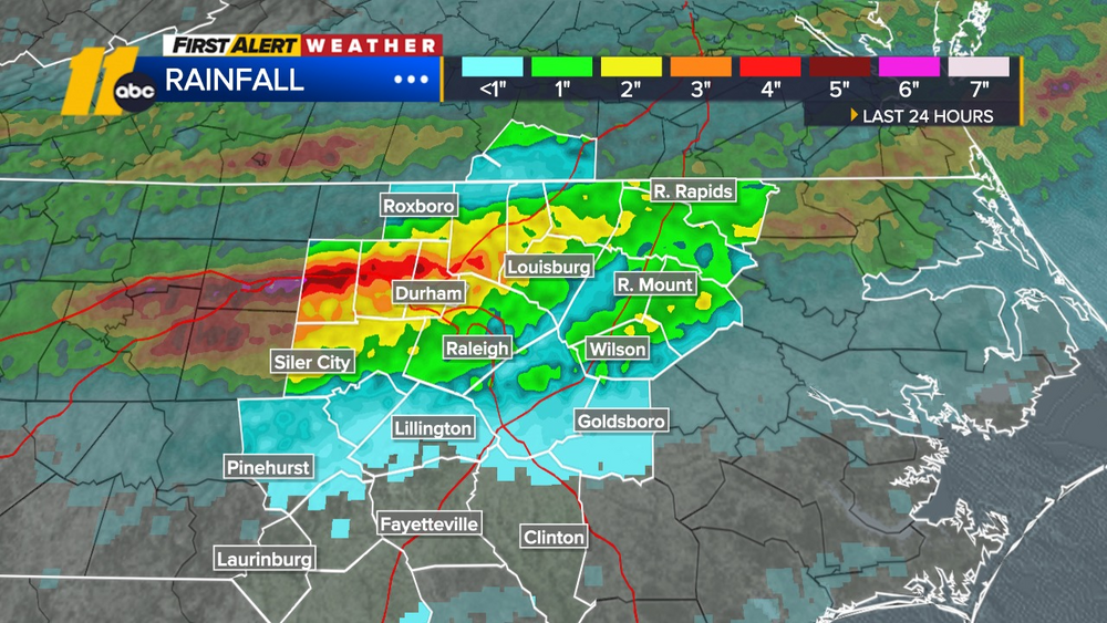
RALEIGH, N.C. (WTVD) -- RDU picked up 2.03" of rain on Thursday, setting a new daily rainfall record.
Heavy rain during the morning across the Triangle has shifted south with the cold front, but not before causing flash flooding in parts of the Sandhills. Saturated ground also contributed to several downed trees across the area.
While the flood threat has decreased from the Triangle northward, the stalled front near the North Carolina-South Carolina border will remain a focus for additional rounds of rain tonight and into Friday morning. Some of that rain could be heavy at times.
Friday won't be a washout. Expect scattered showers in the morning, followed by a mostly cloudy, humid afternoon with many areas staying dry. Another round of rain is possible Friday night into Saturday.
A few thunderstorms could develop Sunday afternoon, but most of the day looks dry and warmer, with highs approaching 90.
Next week brings a return to typical late-July weather, with highs in the lower 90s and a few chances for thunderstorms, especially Tuesday evening and again on Wednesday.
Have a great evening!
Steve Stewart