Unsettled weather returns Sunday with risk of isolated severe storms

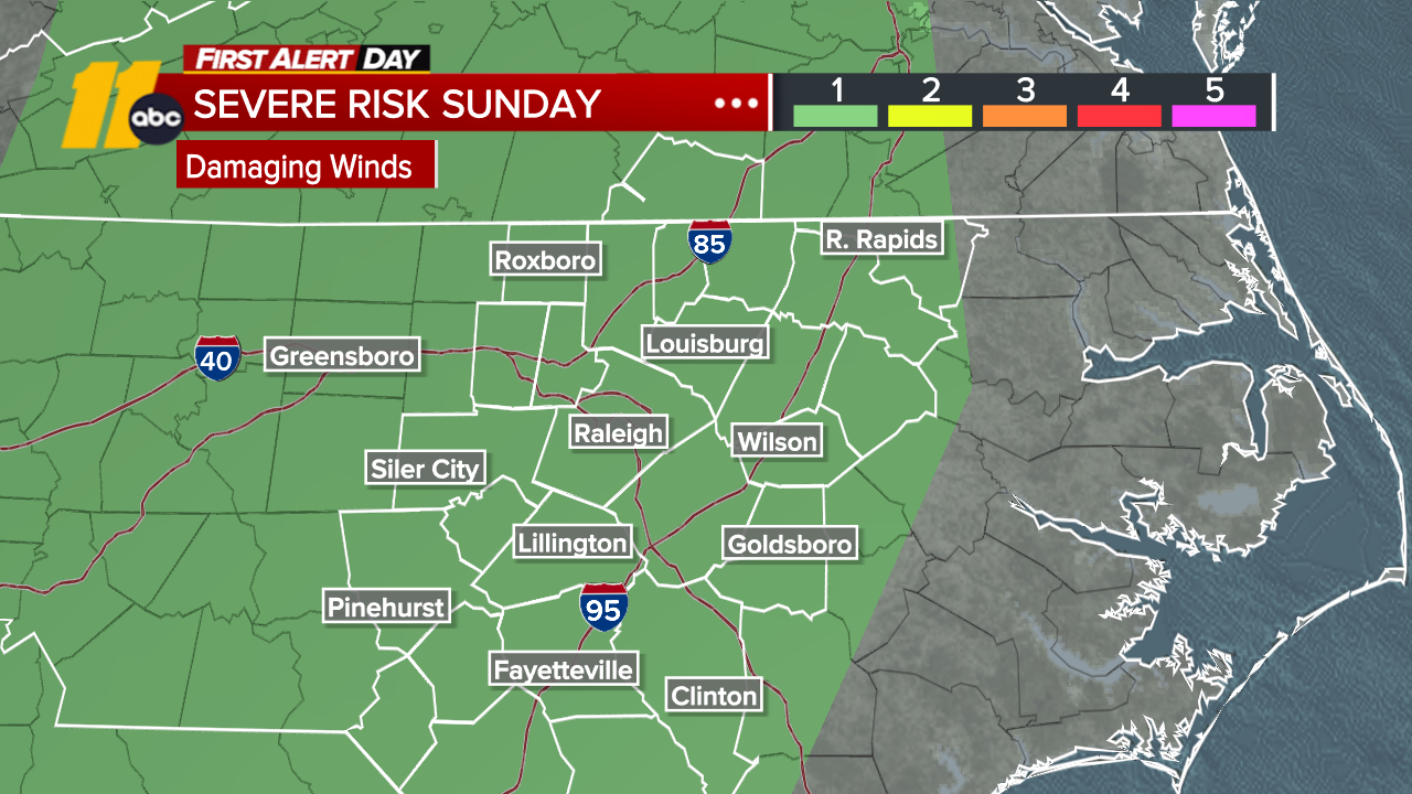
RALEIGH, N.C. (WTVD) -- First Alert Forecast: After a quiet Saturday, a more active weather pattern takes shape to end the weekend. Sunday is a First Alert Day for the risk of a strong storm with damaging winds during the afternoon and evening.
It'll be a warm and muggy evening with temperatures in the 80s.
Tonight turns cloudy and muggy with a chance for a few late-night showers. Sunday looks unsettled with scattered showers and thunderstorms developing during the day.
The Storm Prediction Center has central North Carolina under a Level 1 (Marginal) Risk for isolated strong storms. A few storms could produce brief heavy rain and gusty winds.
Storms will generally move from south to north, which raises the possibility of a few training thunderstorms. If that happens, localized minor flooding could develop in some areas.
Little change is expected Monday and Tuesday, although storm coverage may be a bit lower.
As rain chances become more hit-or-miss by midweek, temperatures will rise to near 90 degrees again through next weekend.
Have a great night!
Cruz Medina