Heat & humidity return to end the week along with storms

RALEIGH, N.C. (WTVD) -- It'll be a warm but pleasant evening across Central NC. Overnight, lows will fall into the 60s. It'll turn a bit humid as winds will be out of the south.
Dew points continue to rise tonight and reach the upper 60s and even the low 70s tomorrow ahead of an approaching cold front. This will make it feel very muggy outdoors.
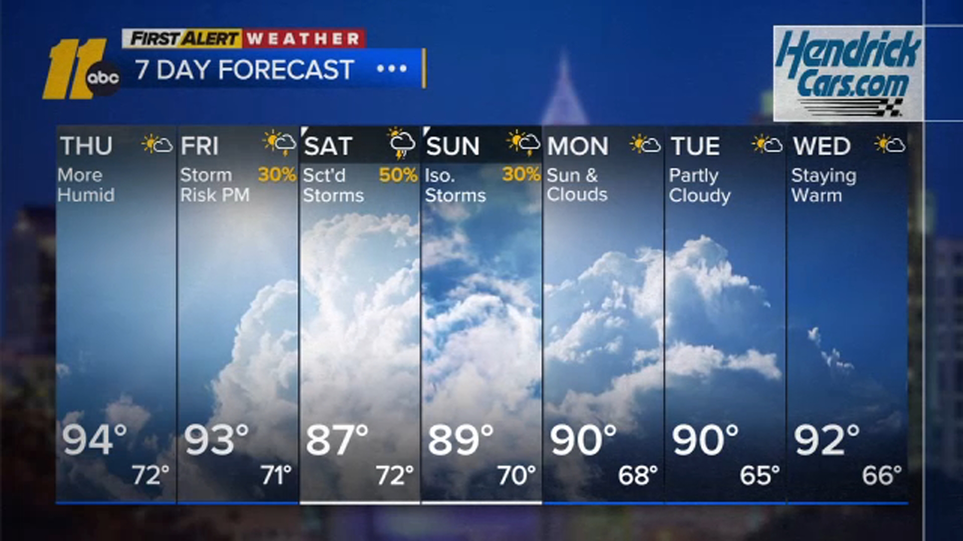
Isolated storms will be possible Thursday evening mainly south of the Triangle. Spotty storms will develop Friday afternoon as the front approaches. Chances will increase Friday evening. Highs Thursday and Friday will be in the low to mid 90s with feels-like temps of 95 to 100. Lows will be in the upper 60s to low 70s.
Scattered showers and storms are likely Saturday afternoon and evening with the front. The threat for gusty winds remains, but widespread severe weather is not expected.
A few showers or storms could linger into Sunday with the weakening front. Weekend highs will be in the mid to upper 80s.
High pressure returns early next week bringing another warm but pleasant stretch of weather.
Highs climb back to around 90 starting Monday. The 90s are expected at least through midweek, possibly longer.


Tropics: No tropical development is expected in the Atlantic basin within the next 7 days.
Have a great evening!
Cruz Medina