September rolls in hot as heatwave grips Central NC

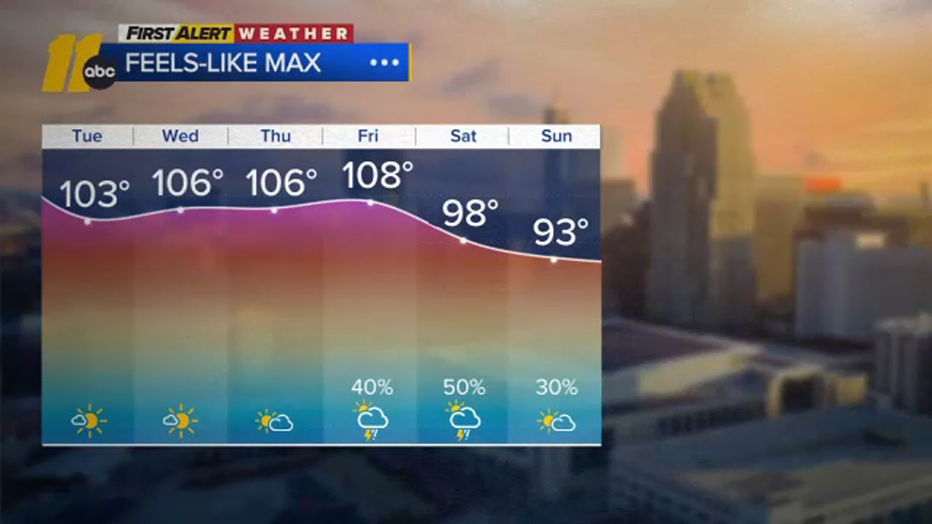
RALEIGH, N.C. (WTVD) -- First Alert-Dangerous Heat: High heat and humidity will return Tuesday and last through Friday. Expect highs in the mid-to-upper 90s with heat indices of 100 to 110 each day.
Good morning and Happy September! The temperature peaked at 96 degrees yesterday at RDU!
The strong ridge of high pressure will continue to expand eastward, bringing a hot, dry start to September and record-challenging temperatures over the coming days.
Anyone with outdoor plans through Friday should prepare for the heat, with feels-like temps of 100 to 110 degrees in the afternoons.
Overnight temperatures will remain in the mid-70s, bringing little relief from the heat, with conditions more akin to the peak of summer.
Later this week, the ridge shifts west as a trough dips south through the Northeast. This will bring a cold front through the region early this weekend, along with thunderstorm chances for the holiday weekend. Models suggest most activity will be south of the area by Sunday morning.
It will turn dry with temperatures near the historical average of 85 degrees for Labor Day. Dew points may drop into the low to mid-60s for the holiday. This is still somewhat humid, but noticeably less so compared to this week.
Eyes on the Tropics
Tropical Storm Edouard Impacting the NW Gulf Coast:
On the forecast track, the center of Edouard is expected to reach the northwestern Gulf Coast within the warning area later today and move inland over southeast Texas tonight. Maximum sustained winds are near 40 mph (65 km/h) with higher gusts. Significant strengthening is forecast today and Edouard could approach hurricane strength before it reaches the northwestern Gulf Coast later today. Rapid weakening is expected after the center moves inland.
STORM SURGE POTENTIAL:
High Island, TX to Vermilion/Cameron Parish Line, LA...3-5 ft
Vermilion/Cameron Parish Line, LA to Morgan City, LA...1-3 ft
RAINFALL: Edouard is expected to produce rainfall totals of 3 to 6 inches, with maximum totals up to 9 inches for parts of the Upper Texas Coast inland through east-central Texas, with potential for 2 to 4 inches in far southwest Louisiana. This rainfall is likely to produce flash flooding, especially in low-lying and urban areas. River flooding may also be possible.
Have a great day!
Kweilyn