Two homes on the North Carolina Outer Banks sit precariously in the high waves with their days seemingly numbered. Since 2020, 11 neighboring homes have fallen into the Atlantic Ocean.
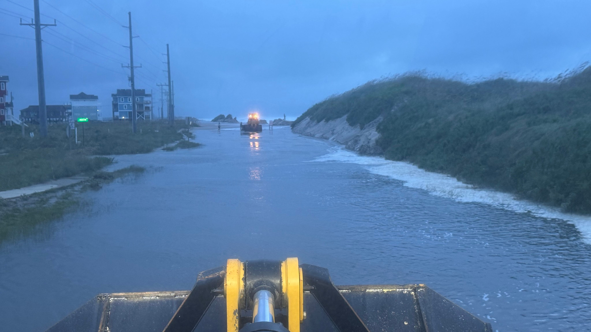
While the swells from storms like Hurricane Erin make things worse, the conditions threatening the houses are always present - beach erosion and climate change are sending the ocean closer and closer to their front doors.
The two houses in the surf in Rodanthe have received plenty of attention as Erin passes several hundred miles (kilometers) to the east. The village of about 200 people sticks out further into the Atlantic than any other part of North Carolina.
Jan Richards looked at the houses Tuesday as high tides sent surges of water into the support beams on the two-story homes. She gestured where two other houses used to be before their recent collapse.
"The one in the middle fell last year. It fell into that house. So you can see where it crashed into that house. But that has been really resilient and has stayed put up until probably this storm," Richards said.
The ocean has destroyed at least 11 houses since 2020
At least 11 other houses have toppled into the surf in Rodanthe in the past five years, according to the National Park Service, which oversees much of the Outer Banks.
Barrier islands like the Outer Banks were never an ideal place for development, according to experts. The islands typically form as waves deposit sediment off the mainland. And they move based on weather patterns and other ocean forces. Some even disappear.
Decades ago, houses and other buildings were smaller, less elaborate and easier to move from the encroaching surf, said David Hallac, superintendent of the Cape Hatteras National Seashore.
"Perhaps it was more well understood in the past that the barrier island was dynamic, that it was moving," Hallac said. "And if you built something on the beachfront it may not be there forever or it may need to be moved."
The Outer Banks even had to move their famous lighthouse from the sea
Even the largest structures aren't immune. Twenty-six years ago the Outer Banks most famous landmark, the Cape Hatteras Lighthouse had to be moved over a half-mile (880 meters) inland.
When it was built in 1870, the lighthouse was 1,500 feet (457 meters) from the ocean. Fifty years later, the Atlantic was 300 feet (91 meters) away. And erosion keeps coming. Some places along the Outer Banks lose as much as 10 to 15 feet (3 to 4.5 meters) of beachfront a year, Hallac said.
"And so every year, 10 to 15 feet of that white sandy beach is gone," Hallac said. "And then the dunes and then the back-dune area. And then all of a sudden, the foreshore, that area between low water and high water, is right up next to somebody's backyard. And then the erosion continues."
'Like a toothpick in wet sand'
The ocean attacks the houses by the wooden pilings that provide their foundation and keep them above the water. The supports could be 15 feet (4.5 meters) deep. But the surf slowly takes away the sand that is packed around them.
"It's like a toothpick in wet sand or even a beach umbrella," Hallac said. "The deeper you put it, the more likely it is to stand up straight and resist leaning over. But if you only put it down a few inches, it doesn't take much wind for that umbrella to start leaning. And it starts to tip over."
A single home collapse can shed debris up to 15 miles (25 kilometers) along the coast, according to a report from a group of federal, state and local officials who are studying threatened oceanfront structures in North Carolina. Collapses can injure beachgoers and lead to potential contamination from septic tanks, among other environmental concerns.
The report noted that 750 of nearly 8,800 oceanfront structures in North Carolina are considered at risk from erosion.
There are solutions but they are expensive
Among the possible solutions is hauling dredged sand to eroding beaches, something that is already being done in other communities on the Outer Banks and East Coast. But it could cost $40 million or more in Rodanthe, posing a major financial challenge for its small tax base.
Other ideas include buying out threatened properties, moving or demolishing them. But those options are also very expensive. And funding is limited.
Braxton Davis, executive director of the North Carolina Coastal Federation, a nonprofit, said the problem isn't limited to Rodanthe or even to North Carolina. He pointed to erosion issues along California's coast, the Great Lakes and some of the nation's rivers.
"This is a national issue," Davis said, adding that sea levels are rising and "the situation is only going to become worse."