

RALEIGH, N.C. (WTVD) -- Several weather alerts, including a Winter Storm Warning, remain in effect until Monday afternoon.
Saturday night, in Central NC, moderate to heavy mixed precipitation, mainly sleet and freezing rain started falling.
WATCH: Winter Weather Special

Most people awoke Sunday to the roads covered with the wintry mix.
Roads, especially bridges and overpasses, remain slick and hazardous.
Duke Energy had 18,000 workers staged across the Carolinas to respond to power outages.
Most school districts across central NC have already made decisions about how to handle Monday's snow day.


Cumberland County declared a State of Emergency on Friday in preparation for the winter storm.
The county noted, "Due to the written request from Mayor Kia Anthony to Chairman Kirk deViere, the Town of Spring Lake is included in this Declaration."
The City of Fayetteville has also declared a State of Emergency.

As a winter storm approaches North Carolina, state leaders are urging preparedness as a top priority.
During a media briefing on Thursday, Governor Stein and other officials emphasized the need to stock up on essentials such as water, non-perishable foods, and medications for the next three to five days. They also recommended gathering flashlights, batteries, blankets, and winter clothing. The state is already preparing to ship supplies to support shelters if necessary.

The North Carolina Department of Transportation (DOT) also held a briefing, stressing that this will be a "marathon, not a sprint." They are urging people to stay off the roads to support their efforts.
DOT outlined a three-phase response plan: Phase 1 involved preparing roads by spreading over 300,000 gallons of brine to prevent snow and ice from sticking. However, officials are also concerned about ice-laden trees and have hired subcontractors to remove downed trees while keeping extra crews on standby.


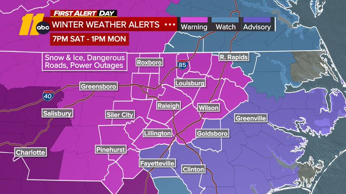
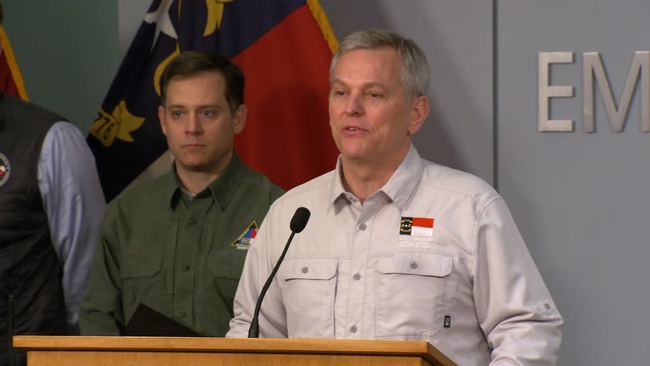
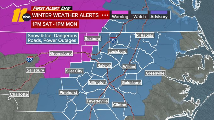
Governor Josh Stein has declared a State of Emergency as a Winter Storm Watch was issued for all of Central North Carolina Saturday afternoon through Monday.
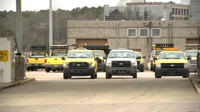
"I encourage all North Carolinians to stay home and off the roads this weekend unless absolutely necessary so first responders can do their jobs safely and effectively," the governor said in a news release. Crews across the state are out brining roads and bridges, but officials warned impacts will likely linger into next week.
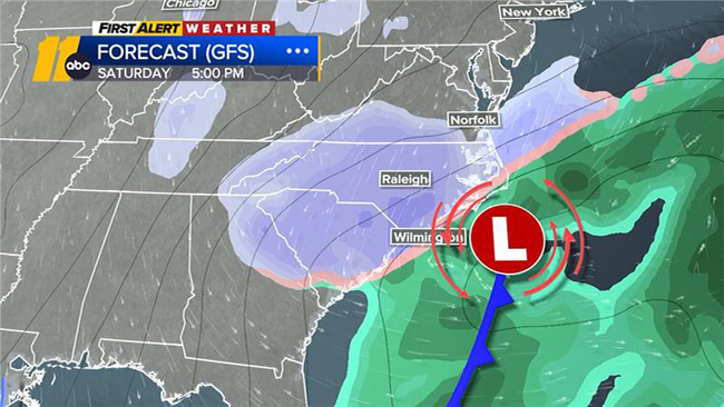
The winter weather is shifting its timeline slightly, with the arrival of precipitation now expected closer to 5 p.m. on Saturday. The forecast calls for snow and sleet to start Saturday evening, transitioning to sleet and freezing rain late Saturday night and continuing through Sunday evening.
SEE ALSO: Weather alerts issued in NC as winter storm approaches
Snowfall totals are likely to stay on the lower end of the 1 to 3-inch range, while sleet accumulations over half an inch are becoming more probable. Freezing rain, however, is expected to be the main concern, with ice accumulations of 0.25 to 0.75 inches possible in many areas.
Temperatures are not forecasted to rise above freezing until Monday, so that will be the first opportunity for any melting. But with low temperatures dropping well below freezing each night next week, any daytime melting could refreeze overnight, potentially creating travel challenges.
The arctic air will also bring unusually low high temperatures in the upper 20s to near 30 on Saturday. This could approach or even break records, with Saturday's record at 27 (set in 2014) and Sunday's at 28 (set in 2013).