Severe weather triggers heavy rain, downed trees, and flood threats across central NC: Live Updates
Last updated: Thursday, July 23, 2026 8:32PM GMT
Watch Eyewitness News, First Alert Weather, and original programming.
RALEIGH, N.C. (WTVD) -- ABC11 First Alert Forecast Team is tracking multiple rounds of showers and thunderstorms expected to move across central North Carolina through Friday, bringing the threat of heavy rain, flash flooding and isolated storm impacts.
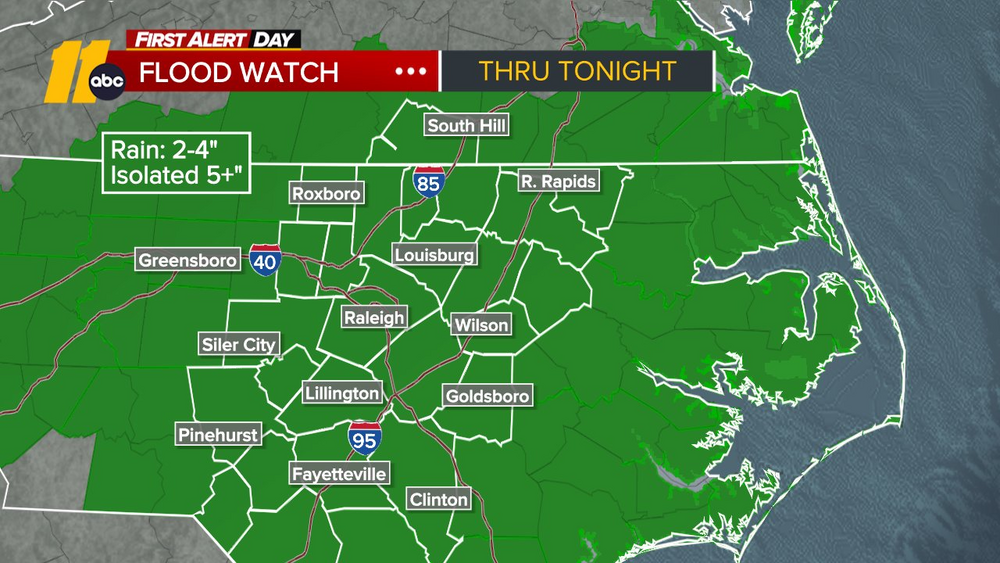
A Flood Watch remains in effect as some communities could see 2 to 4 inches of rain, with locally higher amounts exceeding 5 inches. Heavy downpours may lead to flooding in low-lying areas, along creeks and streams, and on roadways.
Stay with ABC11 throughout the day for the latest weather alerts, flooding reports, power outages and forecast updates.
Key Headlines
Here's how the news is developing.
1 hour and 53 minutes ago
Flooded road closed in Holly Springs
Power outage at The Streets at Southpoint, businesses in the area
The Streets at Southpoint and businesses along Renaissance Parkway and Fayetteville Street in Durham are experiencing a power outage.
Get live updates here
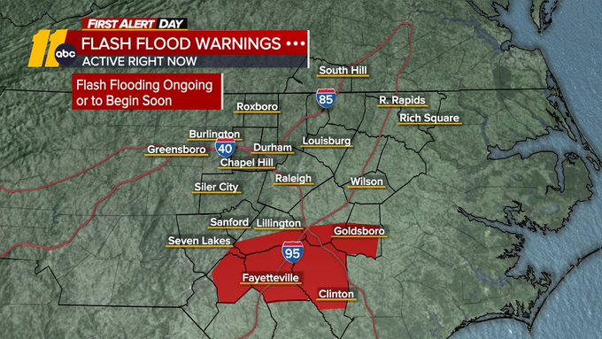
Flash Flood Warning issued for more counties until 3 p.m.
Flash Flood Warning issued for Cumberland, Harnett, Hoke, Johnston, Moore, Sampson, and Wayne until 3 p.m.
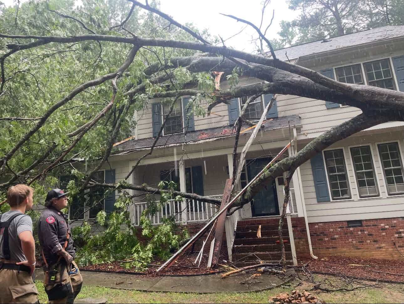
Saturated ground raises risk of falling trees in Wake County, fire department says
Heavy rain is creating new concerns across Wake County, where saturated ground is making trees more likely to fall.
The Northern Wake Fire Department recently responded after a tree fell onto a home. Officials say days of rain have left the soil unable to firmly support some trees, increasing the risk of them toppling with little warning.
Firefighters urge residents to watch for signs of trouble, including leaning trees, exposed roots and cracked limbs, and to have potentially hazardous trees evaluated.
"Sometimes the danger isn't the storm itself, but what it leaves behind," the department said.