Rain moving out, chilly conditions linger


RALEIGH, N.C. (WTVD) -- It was a wet Tuesday and start of Wednesday.
The National Weather Service issued a level 1 severe weather risk for much of North Carolina from 10 p.m. Tuesday until 7 a.m. Wednesday.
Scattered showers began Tuesday morning near and west of Raleigh-Durham International Airport around 5 a.m..
Temperatures climbed into the mid-60s but skies remained filled with clouds and the occasional shower.
Then, by 9 p.m. steady rain began to fall across the region.
SEE ALSO | Mr. Grinch interrupts weather forecast on ABC11 Eyewitness News at 10 a.m.
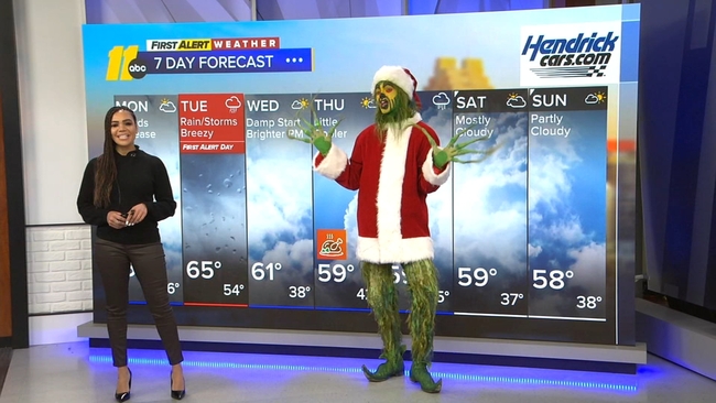
High pressure moved in behind a system on Wednesday, keeping the air dry through Thanksgiving. However, temperatures will not recover. Highs for the holiday weekend will remain around 60 with lows in the upper 30s.