NC Weather: Heavy rain, storms move out; wet weekend ahead


RALEIGH, N.C. (WTVD) -- The return of warmer temperatures brought the threat of severe weather back to central North Carolina starting Friday.
Wake County was one of several counties under a Severe Thunderstorm Warning on Friday afternoon but the advisories have since expired.
Heavy rain started off the morning for much of central North Carolina.
Most of the severe weather appeared to have moved out by Friday evening, but some places bore evidence of the storms. Many counties remained under flood watch into late Friday evening.
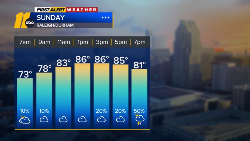
Tomorrow, the spotty nature of the expected heavy thunderstorms may allow for enough gaps to bring temperatures to 90. Weather models hint that activity may also be mainly during the day again and winding down in the evening.
Click here for full weather advisories
Around 12:45 p.m., a tornado warning was issued for Sampson County. The warning lasted for a little over 30 minutes, but there were no reports of a tornado touching down.
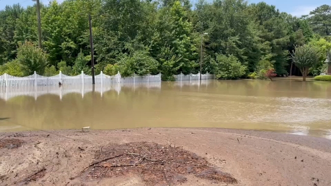
However, SR-1477 (Straw Pond School Road) in Sampson County saw high water because of the heavy rain and will likely be closed until Saturday morning. The affected area is at Mile Marker 4.1 to 3.3, Near Spiveys Corner and Old Cotton Gin Road.
And in Franklin County, SR-1118 (Lane Store Road) near Cedar Creek Road in Franklinton was also closed because of water issues. That issue should be resolved shortly after 4 p.m., officials said.
LIVE | FIRST ALERT DOPPLAR RADAR
There is also a level 1 risk of severe weather for the entire viewing area. Damaging winds, hail, and locally heavy rain will be possible.

The First Alert Weather Team said Friday will have a bit of a lull in the rain around midday. Rain storms, some of which could become severe, will start back up in the early afternoon and be possible through 11 p.m.
These storms will be off and on, so some communities will see a lot of rain, while others may not see much at all.
Humidity will be oppressive Friday, but the cloud cover will limit the temperatures to around 90 degrees. Saturday will see fewer storms than Friday but it will be much of the same as far as cloud cover and temperatures.
Dangerous heat will return next week. Temperatures starting Monday will reach into the mid-90s with feels like temps above 100.