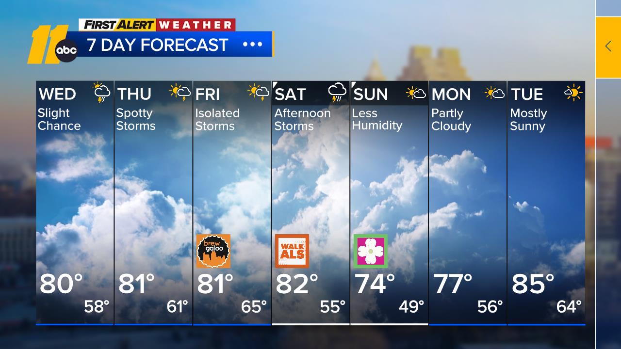
More Clouds, Typical Temps

RALEIGH, N.C. (WTVD) -- Mid and high level moisture will continue to stream in from the west tonight and tomorrow as what is left of Hurricane Francine continues to dissipate over the middle Mississippi River Valley. Skies will end up rather cloudy here tonight and tomorrow, but in the absence of any strong trigger mechanisms, any showers which form will not be well organized and scattered about across the central part of the state. Rains will be more organized tomorrow toward the southeast coast, where there can also be a heavier thunderstorm or two. Saturday will be fairly similar with a few hit or miss showers over the triangle and a more organized area of rain toward the coast.
There is still not good consensus amongst models regarding the low pressure expected to develop off the Southeast coast early next week. It will have some tropical characteristics but it may not be purely tropical in nature. There is however, strong consensus on high pressure aloft and at the surface over New England. This setup will push any area of unsettled weather along the coast well inland early next week. The amount of rain and wind generated by this storm is still up for debate, but one thing for sure is that it will be rather cloudy and humid Monday into Tuesday with varying amounts of rain. If the storm reaches its full potential, there could be several inches of rain and flooding. In any case, this system should be off to our north and west by the middle of next week. This will allow the cloud cover to begin to break up and bring most of the rain to an end.
Tropical Discussion: Francine made landfall as a Category 2 hurricane in Louisiana Wednesday afternoon, bringing heavy rain and high winds to much of coastal Louisiana and Mississippi. Francine is expected to continue losing wind intensity before dissipating late Friday in the mid-Mississippi River Valley. An area of low pressure off the southeast coast is being monitored for potential tropical development early next week. TD 7 has been classified in the eastern Atlantic, and will track west over the open waters of the Atlantic before turning to the north in the central Atlantic early next week. Other tropical waves in the central Atlantic are being monitored, but no development is expected.
Have a great evening!
Big Weather


