Heat wave in North Carolina with high heat indexes and warnings officially ends Thursday

Heat advisory is in effect across our viewing area into midweek.

WTVD logo
Last updated: Friday, August 1, 2025 9:21AM GMT
Heatwave in central NC begins with near-record highs

RALEIGH, N.C. (WTVD) -- Thursday will be the last day in a nearly week-long stretch of high heat and humidity.

A Heat Advisory is in effect along and east of US-1 from Noon until 8 pm. for feels-like temps of 105 to 109. Highs will be in the low to mid-90s.

A slow-moving cold front will approach from the north and west on Thursday, resulting in scattered rain and storms later in the day/evening. Locally heavy rain and a few gusty storms will be possible.

The front will linger Friday before passing south Friday into the evening. The risk of locally heavy rain and street flooding will be higher on Friday in the Triangle and south.

Highs will be in the upper 80s with feels-like temps in the low 90s. Lows will dip into the mid/upper 60s.

Key Headlines

Here's how the news is developing.
Cruz Medina  Image
Jul 30, 2025, 4:52 AM GMT

Here's when the heatwave will end and storms begin

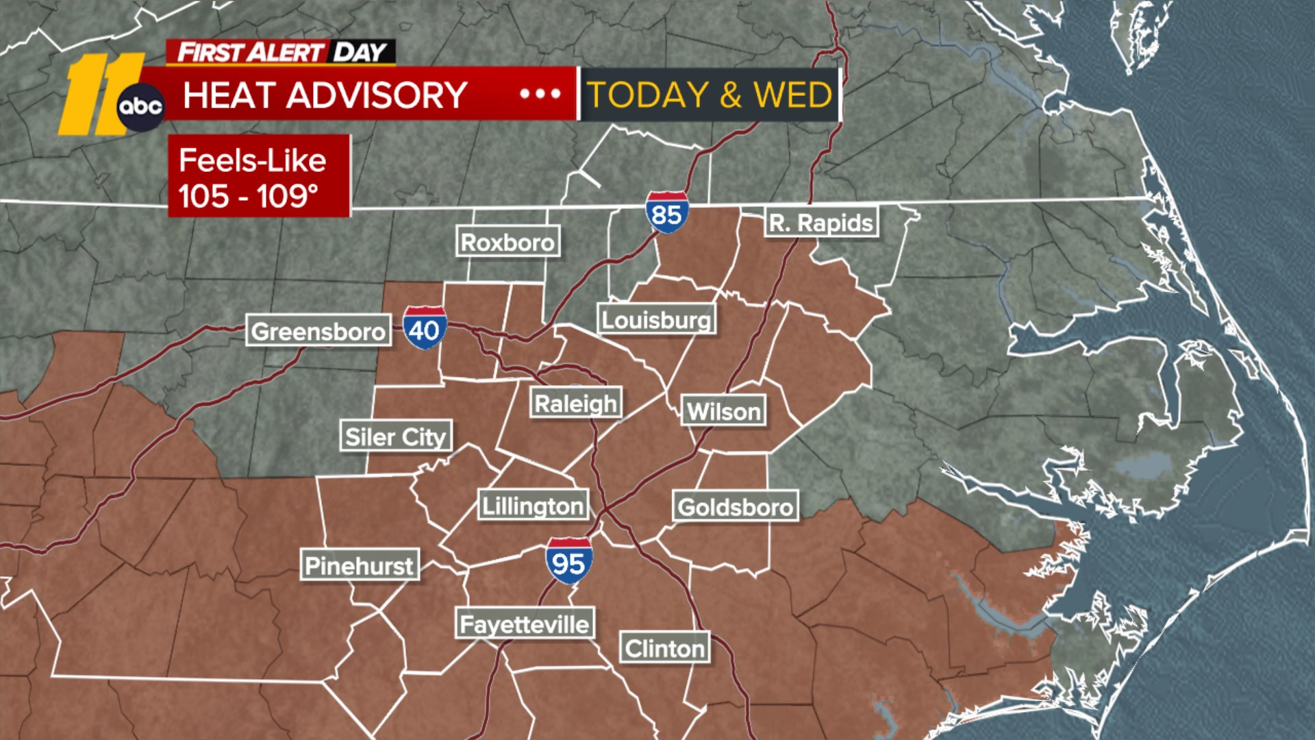
A Heat Advisory is effective for Wednesday from 10am until 8pm for feels-like temps of 105 to 109.

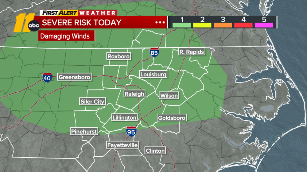
The heat wave will officially end Thursday with highs in the low 90s. However, storms potential ramps up as well.

A cold front will approach from the north and west, resulting in scattered rain and storms later in the day/evening. Locally heavy rain and a few gusty storms will be possible.

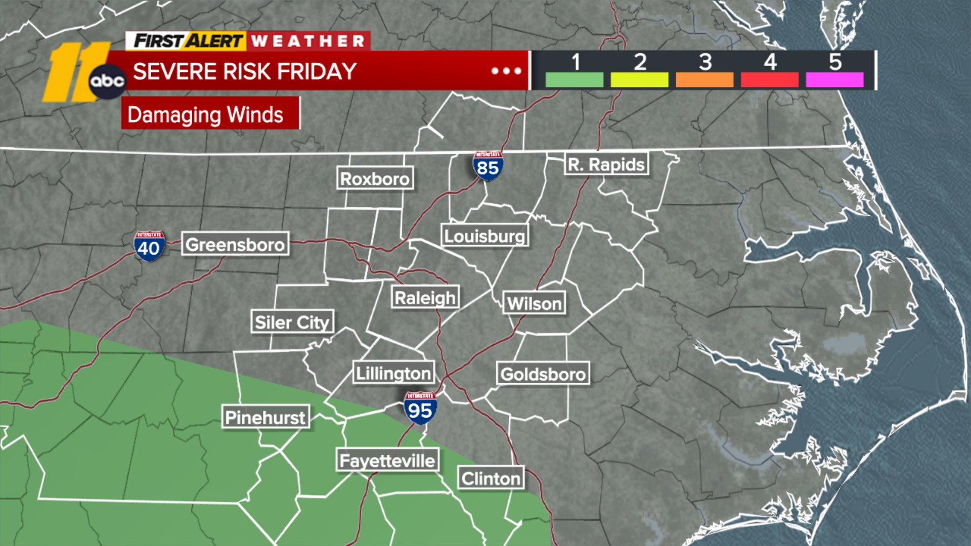
The front will linger Friday before passing through the immediate region later on Friday and into Saturday morning, resulting in showers and thunderstorms into Friday as well as a noticeable temperature drop. Late in the day on Friday now features the potential for flooding as a result of high rain rates that are expected.

Full Forecast here

Elaina Athans Image
Jul 30, 2025, 3:28 AM GMT

Heatwave tests power grids

Duke Energy says overall, the electric grid is performing well with the extreme heat, but there have been sporadic outages in some neighborhoods.

ABC11 News found grid workers out ensuring customers stay online.

Duke Energy Spokesperson Jeff Brooks says the weather has not caused a widespread outage, and self-healing technology, which can reroute power, has helped.

There's also staff working around the clock to keep the system running.

SEE ALSO | If you lose power: Here's how to report and check power outages in your area

Jamiese Price Image
Jul 29, 2025, 6:12 PM GMT

Wake EMS seeing increase in heat-related calls

The heat has been relentless and it's taking toll on people's health. WakeMed reported a dozen cases of heat exhaustion. Providers have also treated at least 30 cases of heat related illnesses since Friday, including 12 on Sunday alone.

Wake EMS are medical providers who are treating patients before they make it to the hospital. They are also seeing an increase of heat related calls. They treated 37 patients over the weekend for being over-heated and dehydrated.

The EMS Deputy Director encouraged people to stay inside if you can.

"If you do have to be outside, please take care of yourself mostly prior to going outside," said Curtis Fuko with Wake EMS.

"Make sure that you're pre-hydrating, that you're ready to go out to the elements, understanding that once you get out there, the hydrating that you're going to do at that point is just trying to keep up with what you have already inside of you," he continued.

Fuko said if you are out and get overheated make sure you get inside to a cool space immediately. "Get yourself out of the elements into someplace cool, whether it's a car or whether get in the shade to get out of that direct sunlight. Pool, of course, will help cool you off a nice, cool shower will take care of that. "

Doctors shared the signs of heat exhaustion include sweating, headache, nausea, and vomiting. Confusion is one of the early signs of heat stroke and needs to be treated immediately.

Full Forecast Here

WTVD logo
Jul 29, 2025, 9:28 AM GMT

Spotty storms Tues. afternoon; Heat advisories in place through Wednesday

A Heat Advisory has been issued for central North Carolina for Tuesday and Wednesday, covering the following counties: Orange, Durham, Chatham, Wake, Johnston, Moore, Lee, Harnett, Wayne, Scotland, Hoke, Cumberland, Sampson, Warren, Halifax, Franklin, Nash, Edgecombe, and Wilson.

There is a risk of afternoon and evening spotty storms on Tuesday.

Wednesday is expected to be last day of the heat wave with highs in mid to upper 90s. There's also a chance for thunderstorms in the afternoon.

See latest weather alerts here.