
Storm chances ramp up as temps drop into the 80s
A slow-moving cold front will approach from the north and west Thursday, resulting in scattered rain and storms later in the day/evening. Locally heavy rain and a few gusty storms will be possible.
Highs will be in the low to mid-90s.
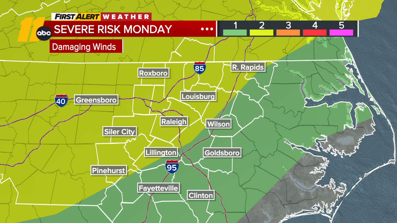
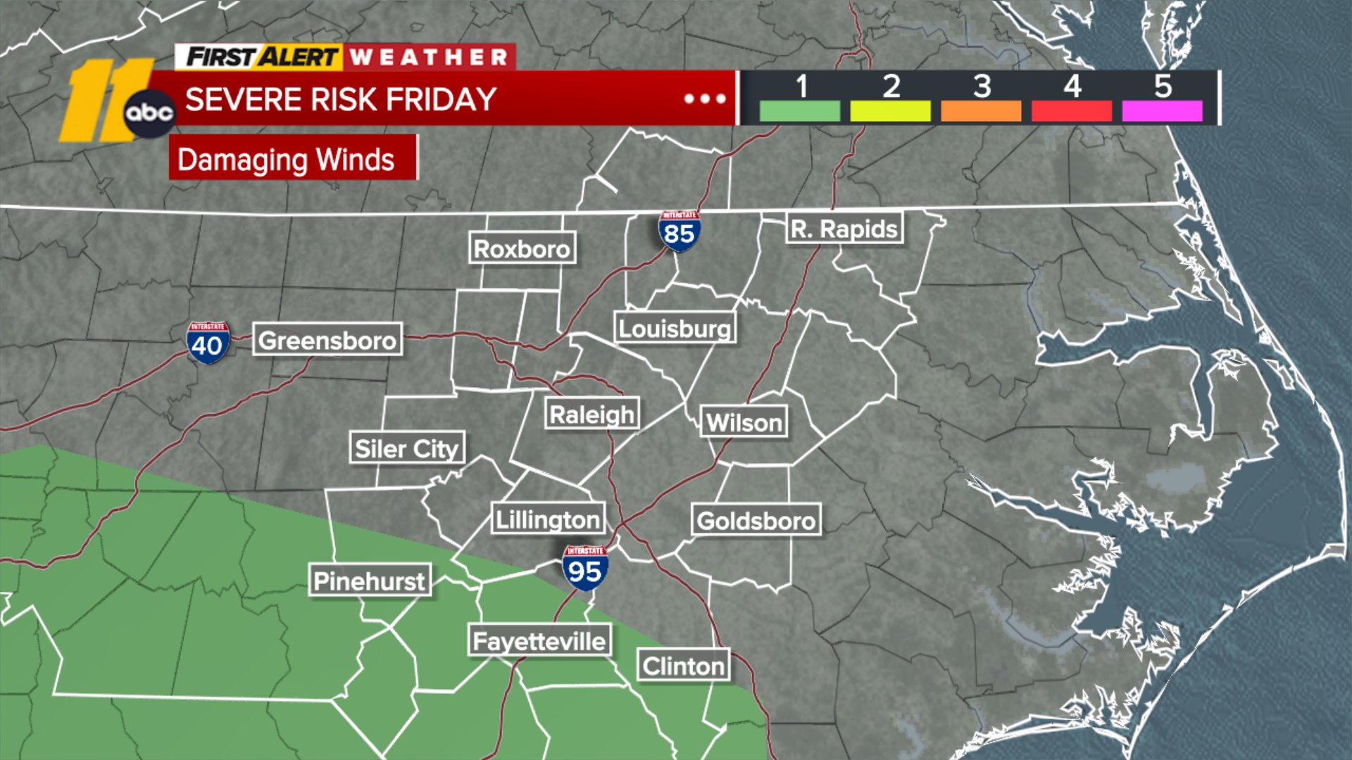
The front will linger Friday before passing through the immediate region late Friday into Saturday morning, resulting in showers and thunderstorms. The risk for locally heavy rain and street flooding will be a category higher Friday from the Triangle and south.
Highs will be in the upper 80s with feels-like temps in the low 90s. Lows will dip into the mid/upper 60s.
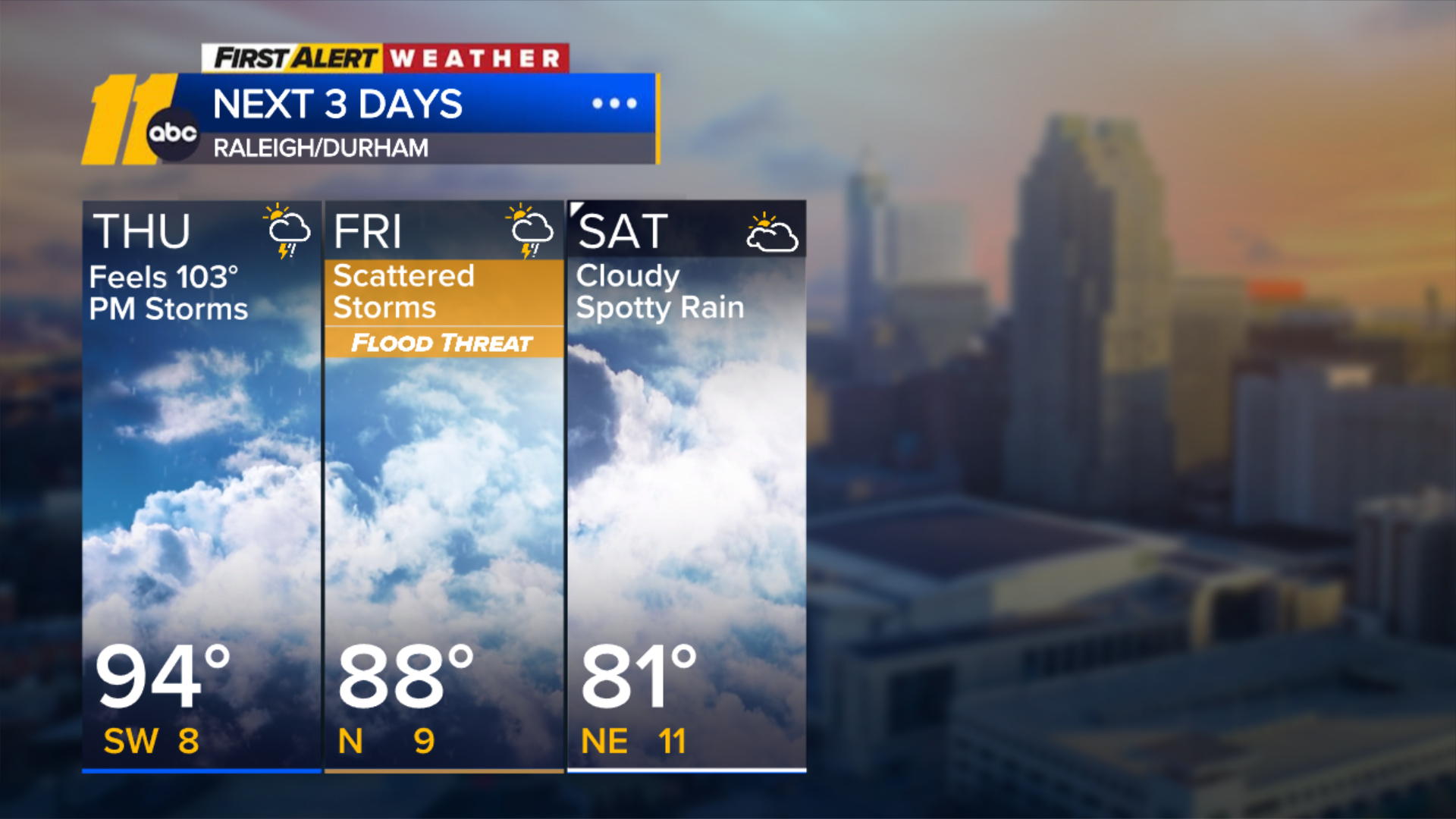
Spotty showers will be possible early Saturday morning until the front slips south. Highs will be in the upper 70s and low 80s Saturday temperatures can dip into the low 80s by Saturday and Sunday with lows in the mid/upper 60s.
This will be the first time RDU has seen highs in the low 80s since the beginning of July.
The front will remain just offshore the NC coast into early next week, so there's the chance for an occasional shower or two into early next week, especially on Tuesday. Highs will be in the low to mid 80s through early next week.