Heat advisory in effect as 98 high feels well above 100 degrees: First Alert Day


RALEIGH, N.C. (WTVD) -- The hottest temperatures of the year are consuming central North Carolina. ABC11 has declared Friday and Saturday as First Alert Days because of the extreme temperatures.
The temperature is going to be dangerously hot, rising into the upper 90s. The feels-like temperatures could even rise above 110 degrees for some areas on Saturday.
A heat advisory is in effect through Saturday evening.
The National Weather Service says a heat advisory is issued when the maximum heat index temperature is expected to be 100 or higher for at least 2 days and night time air temperatures will not drop below 75.
Strong high pressure will remain in place over the region that is funneling hot, moist air into the area.
Spotty, isolated showers are possible later today. It doesn't take much this time of year for a small pop-up thunderstorm to develop, but most of the activity looks to remain to our south in South Carolina.
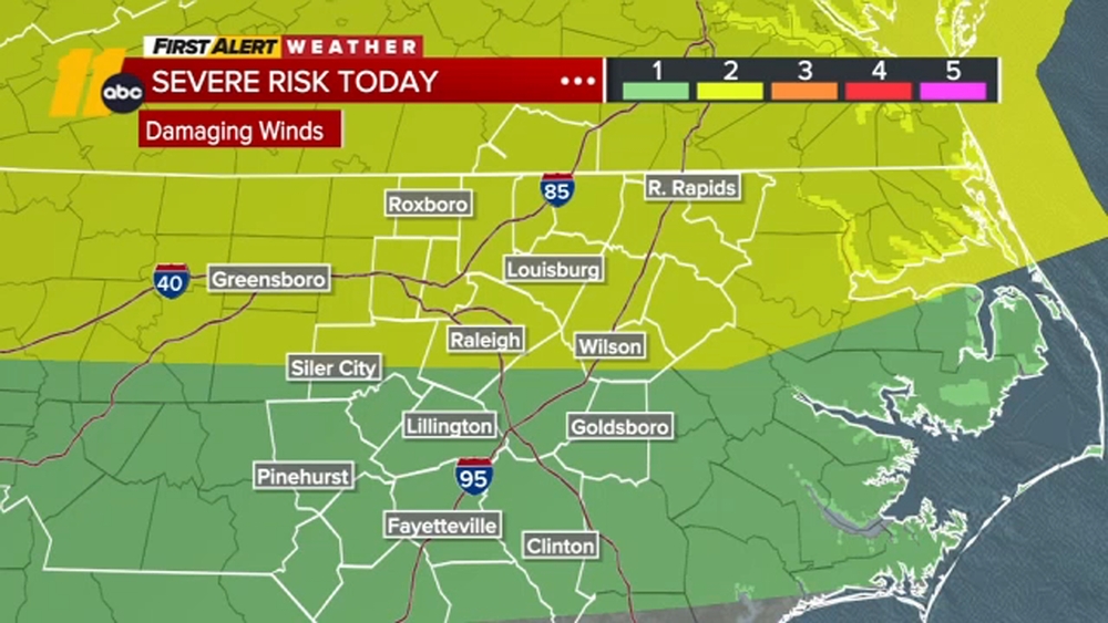
There is a level 1 risk for damaging winds with any pop-up storms.
By tomorrow, there could be more widespread thunderstorm activity across the Triangle during the late afternoon and especially the evening mainly over the northern portion of the state where the boundary should linger into during peak heating hours.
While the severe risk seems marginal at best, any thunderstorm can bring flooding downpours and perhaps locally damming wind gusts just given the sufficient amount of moisture in the atmosphere.
Sunday a front moves into the area by evening, out ahead of this front we should kick off some scattered showers and storms.
Cooler next week with highs closer to our seasonal highs and low rain chances.