Level 3 risk for severe storms for part of central North Carolina


RALEIGH, N.C. (WTVD) -- A severe thunderstorm pushed its way through Halifax County and surrounding areas Monday afternoon.
The storm contained strong winds and a lot of lightning. Fortunately, there's not been any reports of significant damage so far.
The severe thunderstorm risk remains possible until 11 p.m. across the region.
Halifax and Northampton counties have the rare level three risk, while most of the rest of the region is under a level two risk for severe storms. Damaging wind gusts, hail, lots of lightning, and downpours will be possible.

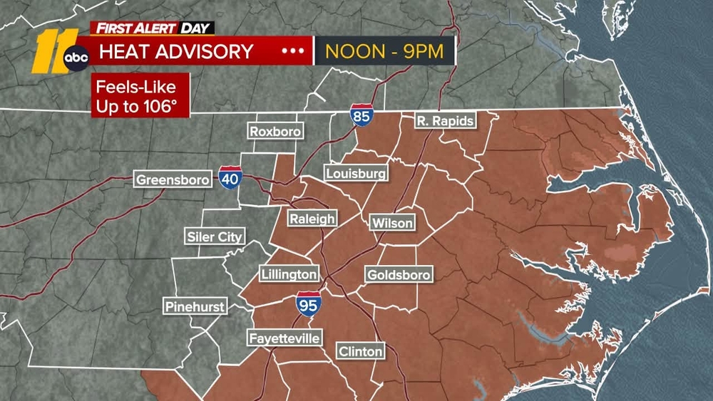
A heat advisory is also in effect for all of central NC until 8 p.m. Feels-like temps will range between 103 and 109.

Yesterdays high of 96 makes it 3 straight days with a high above 90 degrees for RDU. That trend will continue through the week with highs in the 90s along with elevated humidity making it feel very muggy.
The coverage of storms will be more widespread with a cold front approaching from the west increasing the threat of severe storms compared to yesterday. The SPC has RDU solidly inside the slight risk with a 15% risk for wind and hail.
Behind the front, July 4 will bring a few spotty storms. As of this writing, the best chance for chance for storms will be south of the Triangle and along the coast. Afternoon highs will be in the low 90s, with feels around 105. Temps will be in the low 80s during fireworks time. It will feel more like the upper 80s.
RELATED | Cooling stations open in Wake County as temperatures soar above 90
Away from the heat, Sunday stayed mostly dry into the afternoon hours. A couple of thunderstorms rolled into the area from the north and west prompted warnings across the state.
ALSO SEE: Heavy rains cause SUV to hydroplane, crash on I-95 in Cumberland County