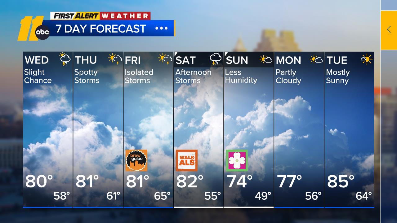
Scattered storms return Friday
RALEIGH, N.C. (WTVD) -- The front remains stalled over southern North Carolina. Showers are currently across far western portions of the Piedmont and west, while the rest of the state remains dry due to high pressure off the mid-Atlantic coast near the Delmarva area.
Shower and thunderstorm activity is set to increase Friday afternoon as moisture increases as flow turns more southerly and 500 MB energy shifts eastward. CAPE will also be increased as well. The shortwave trough moves overhead late Friday night into Saturday morning, which can also spark a spotty shower or t-storm at night, though instability will be limited due to lack of daytime heating.
Thunderstorm activity increases again during the day on Saturday as the associated front passes through. The European model is slower compared to the American. It provides much more instability and moisture around to work with on Saturday, so we will have to watch for a heaver t-storm in the mix.
Dry conditions will return on Sunday and flow from the north will bring in cooler and drier air behind the front, leading to a nice end to the weekend. High pressure will build in, which will keep dry and mostly sunny conditions around through early next week
Have a great evening!
Big Weather


