Tropical Depression Chantal brings heavy rain, flooding and tornado warnings to central NC

RALEIGH, N.C. -- Tropical Storm Chantal continues to move through Central NC Sunday afternoon. Although the storm is in a much weaker state, the threat for flash flooding and isolated tornadoes remains in place through the rest of the evening.
Radar estimates of 3-7" of rain in Lee, Montgomery, and Moore counties have prompted a Flash Flood Warning this evening for that area.
A Flood Watch is in effect for most of Central NC through 6am on Monday.
The storm will lose organization as it speeds northeastward on Monday. Much of the showers and thunderstorms likely stay east of the Triangle during the day, but a few could still be around by the morning. With Chantal losing wind intensity, not much in the way of gusty winds will be expected by this point.
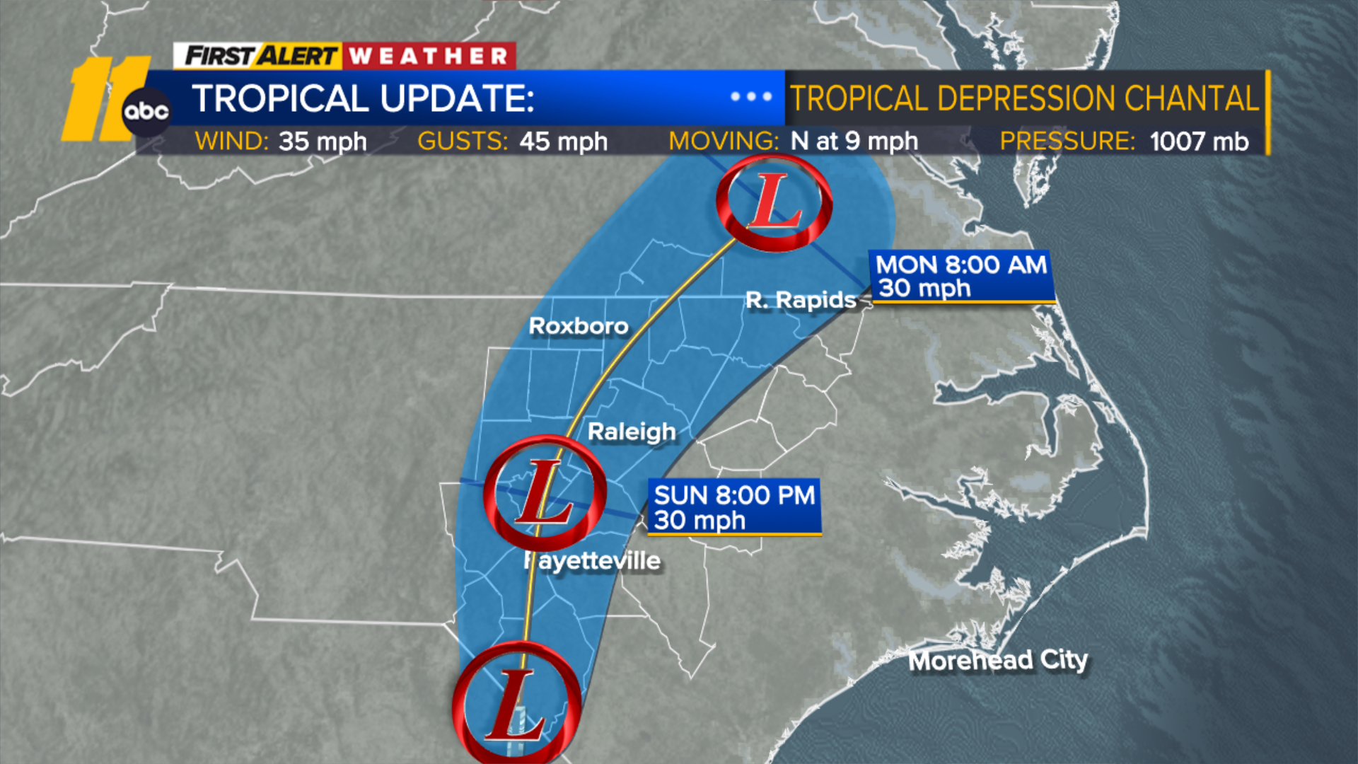
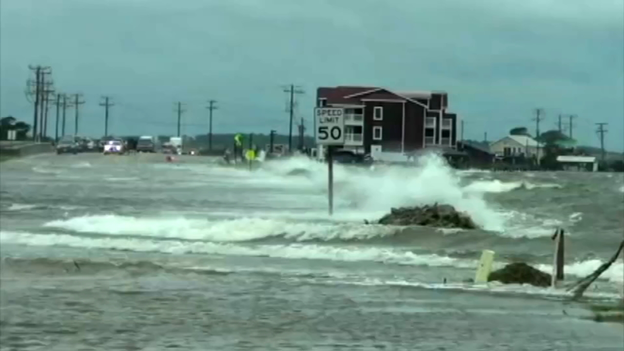
The storm made landfall near Litchfield Beach, South Carolina, according to the National Hurricane Center. Its maximum sustained winds have since decreased to 35 mph. Chantal is currently moving to the north at 9 mph.
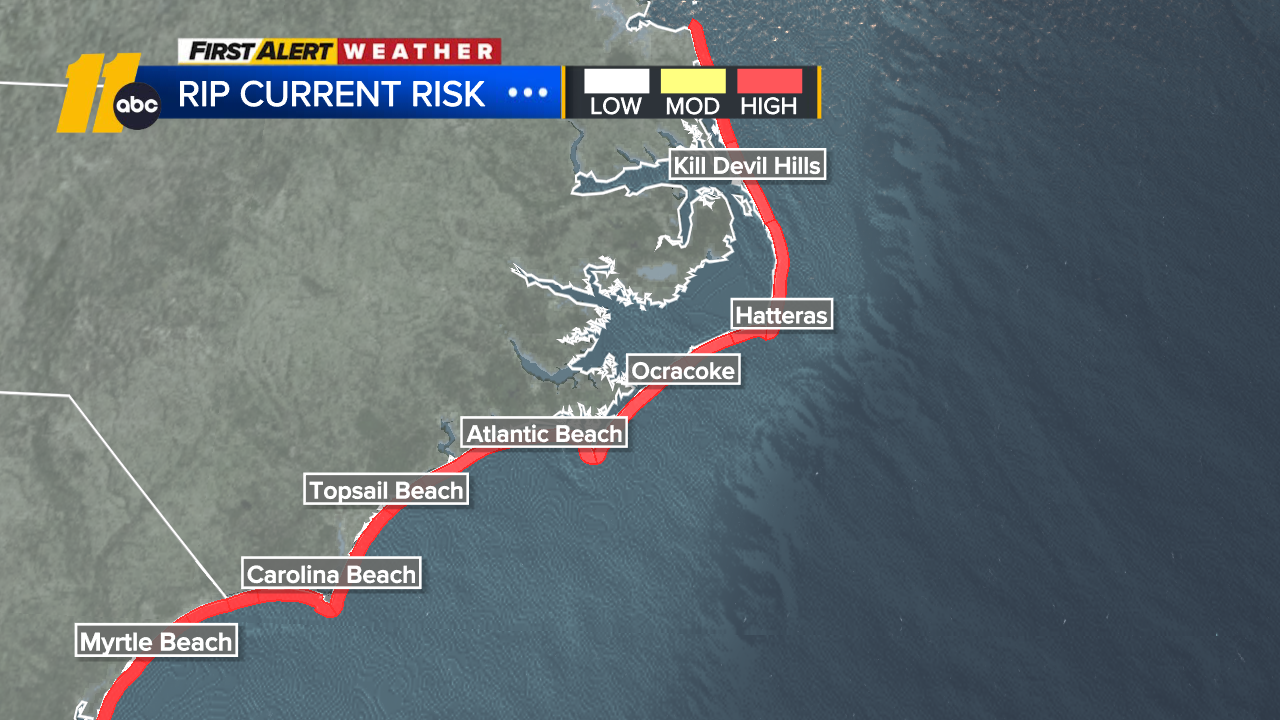
Heavy rain is expected for parts of North Carolina through Monday, with total rainfall of 2 to 4 inches (5 to 10 centimeters) and local amounts up to 6 inches (15 centimeters) that could lead to flash flooding.
South Carolina's Emergency Management division had warned residents earlier of the possibility of isolated tornadoes along the coast and of minor coastal flooding.
It also warned drivers not to venture on water-covered roads or around road-closure signs where flooding occurred.
Flood watches remain in effect at least until Sunday night from Myrtle Beach to the west of Wilmington, North Carolina.
Chantal is the third named storm of the Atlantic hurricane season.